Subscribe to our social channels to get the latest news about Hungary!


As winter continues to grip Hungary, residents are bracing for a challenging Wednesday with forecasts of freezing rain and snow across various regions. The Hungarian Meteorological Service (HungaroMet) has issued warnings for several counties, urging citizens to exercise caution due to potentially hazardous weather conditions.
The day is expected to start with overcast skies in most parts of the country, with only the northeastern regions experiencing clear or partly cloudy conditions initially. However, cloud cover is anticipated to increase throughout the day, bringing with it a band of precipitation moving from the southwest, Blikk reports based on the HungaroMet forecast.
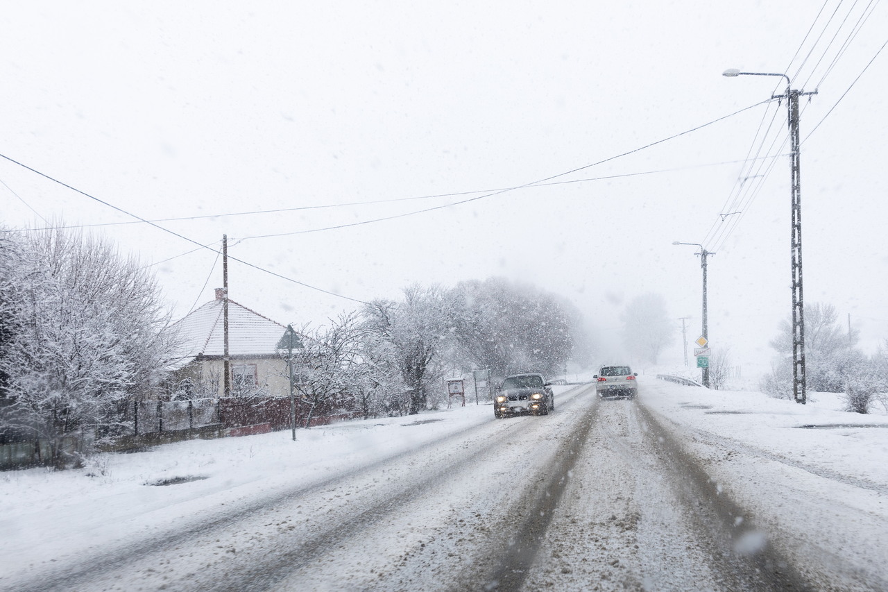
Daytime temperatures will range from 0 to 8 degrees Celsius (32 to 46 degrees Fahrenheit), with the northeastern parts experiencing slightly warmer conditions. By late evening, temperatures are expected to drop to between -2 and 1 degrees Celsius (28 to 34 degrees Fahrenheit).
HungaroMet has issued first and second-level warnings for several counties due to the risk of freezing rain. The areas most likely to be affected by prolonged freezing rain include:
These regions may experience significant ice accumulation, potentially creating hazardous conditions for travel and outdoor activities.
While freezing rain is the primary concern in some areas, snow is also expected to play a role in Wednesday’s weather:
The precipitation is expected to continue into Thursday, with the weather system moving towards the northeast. While western regions may see the precipitation tapering off, the northeastern parts of Hungary could experience light snowfall. Southern areas are likely to transition to freezing rain or rain as the primary form of precipitation.
As we look further ahead, forecasts suggest that the beginning of next week may bring severe night frosts, although no precipitation is expected during that time. Residents are advised to stay informed about the latest weather updates and take necessary precautions when venturing outdoors or travelling, especially in areas where freezing rain and snow are expected to create challenging conditions.
Earlier this year: 90-year heat records broken in Hungary
Earlier this month: PHOTOS, VIDEOS: Winter is here, snow has covered multiple Hungarian regions!


