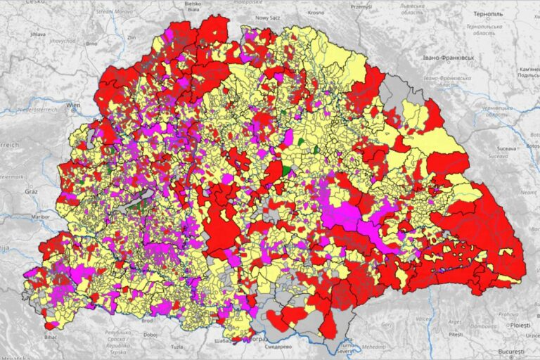
What did medieval Hungary look like? – new free downloadable map shows

The Eötvös Lóránd Research Network of the Eötvös Lóránd University’s Research Centre for Humanities has created the digital atlas of Hungary of the late medieval, MTI writes. Based on the research carried out within the framework of the Árpád-ház Program, the experts renewed and reiterated Pál Engel’s database on the historical medieval settlements of Hungary, which was published on CD-ROM 20 years ago.
ELKH reports that thanks to the developments of technology, the data has become available to anyone on the Internet. The database was originally created 20 years ago with the support of Országos Tudományos Kutatási Alapprogramok or OTKA (loosely translated to Basic National Scientific Research Programs) and the Akadémiai Kutatási Pályázatok (Academic Research Applications) at the Institute of History of the Hungarian Academy of Sciences between 1993 and 2001.
The digital atlas presents a detailed map of the Kingdom of Hungary in the late Middle Ages, a few decades around the 1500s.
According to 24, it contains all the settlements – cities, towns, market towns, villages, rural living areas, castles and monasteries, which add up to more than 23,000 in total – that existed at that time and whose location could be at least approximately determined by scientific methods or historical evidence. The major bodies of water are also present on the atlas, and the county boundaries of the age are also marked. In addition to the major waters and county borders, however, the atlas also indicates the boundaries of significant royal, ecclesiastical, and secular properties of land (as of 1498).
A descriptive database is also connected to the map, which contains the most important data about the settlements marked on the atlas.

During the project led by the Faculty of Humanities of Eötvös Lóránd University, the entire data was transferred to a geographic information system (GIS) environment that meets today’s standards. Both the modern executable and the further development of the original database were performed by Térinfo Bt., the same company that developed the first edition 20 years ago.
Recently, a few interesting archaeological finds were unearthed in the systematic excavations of the Buda Castle, for example, Sisi’s lost treasures.
The renewed database, which is now available to anyone on the Internet by downloading a driver, contains many improvements and new elements in addition to the unchanged original content. For example, OpenStreetMap is built-in, so it opens automatically; the SRTM (Shuttle Radar Topography Mission) topographic model has been also included, and changes in the ownership of lands between ages can be displayed as a new map;
the geometry of the database became more precise and the GIS environment running the database was completely renewed.
The program has many options to browse, and many of them are organised into layers. You can turn these layers on and off and even search for specific data or places within each layer. You can find the user guide HERE, which, unfortunately, is only available in Hungarian. Still, it is illustrated with screenshots from the program, and some of the interfaces of the program are available in English. Have fun browsing the Hungary of the middle ages.
Source: 24.hu, ELKH.org


I really wanted to see it. It’s unfortunate that it’s not in English yet. But, someday I’ll learn Hungarian to know more about it.
I really wanted to see it. It’s unfortunate that it’s not in English yet. But, someday I’ll learn Hungarian to know more about it.
Thanks for the article, Péter.