weather

PHOTOS: Extreme cold to come next week in Hungary, snow, frost covers the country
Budapest

Next week will be the coldest period of this winter, the Hungarian Meteorological Service (OMSZ) told MTI, the Hungarian News Agency. As a result, there will be a lot of ground frost, impacting plants considerably.

In January, a constant West-South West wind stream brought wet and mild weather to the Carpathian Basin in the last few weeks. However, the direction of that wind stream changed last week to the Northwest, causing less precipitation and a temperature closer to the country’s historic winter average.

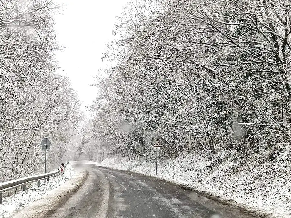
In the Bakony Mountain, 10 cm of snow is expected today:

The OMSZ added that Monday morning would be the coldest. The temperature will be between minus 1 and 9 degrees. Everybody should prepare for that change since until now, the average temperature of the last 30 days exceeded the normal by 3-6 °C. Thus, the difference will be palpable.

Snowfall in the Mátra:

And on the Kékes (1014m):

Until now, ground frosts were rare in most Hungarian territories. The upper layer of the ground froze only for some nights. OMSZ recalled that the mild winter harmed plants and disturbed their vegetation cycle. Furthermore, the number of parasites and pathogens was not reduced because of the warm weather.

OMSZ highlighted that the mild weather was dangerous, especially on fruit trees. If their deep relaxation period ends too early, they can become extremely sensitive to frost. Interestingly, the blooming of the hazelnut started even in Northeast Hungary.

KÅ‘szegi Mountain in West Hungary:

Thus, it is good news that next week will probably be the coldest in Hungary this winter. That is because an Arctic air mass is to cover the Carpathian Basin from Saturday. As a result, wind speed may reach 120-130 km/h in some parts of the country.

The warning of the Metkép:

Here is a wind map:

The temperature will be around 0 degrees, but individual comfort might even be lower because of the hurricane-like wind. From Sunday, the temperature will be below 0 even during the day in the Northeastern regions.

From Sunday, the temperature might go below minus 10 degrees in some parts of the country. Thus, the first period of next week will be the coldest this winter bringing a lot of ground frost.

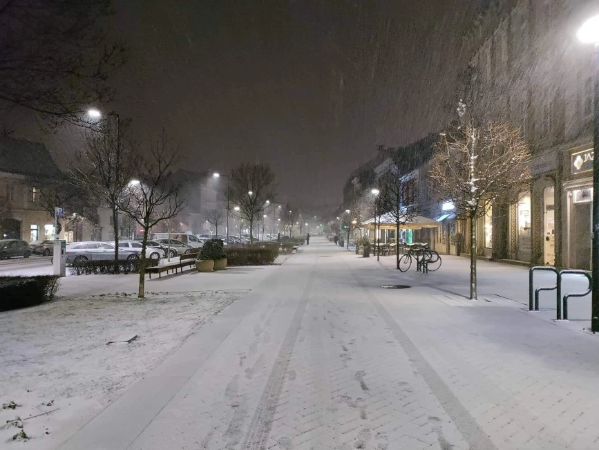
Sopron snow Hungary
Read alsoPHOTOS: Parts of Hungary covered in snow, -10 °C to come next week!

Snow shower and frost to come to Hungary this week – weather forecast

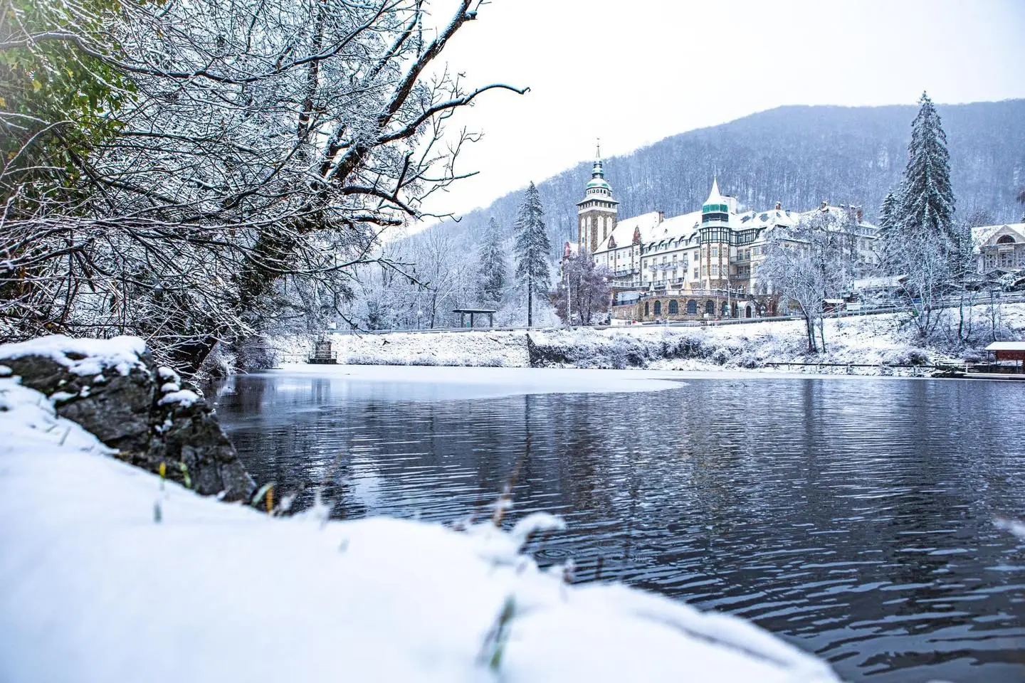
Lillafüred snow Hungary cold snowfal

Showers and snow showers are expected on Thursday, with the possibility of heavy snowfall on Friday. A short weather forecast for the rest of the week.

Thursday, 2 February

On Thursday, with variable cloudiness, showers and snow showers are expected in several areas, 24.hu reports. Initially, snowy rain and some sleet may occur in the southwest. Winds from the west-northwest will be strong in many areas, with gusts possible in the higher elevations. Temperatures are expected to be -4 to +4 degrees Celsius at dawn and between 5 and 9 degrees Celsius in the early afternoon.

Friday, 3 February

On Friday, the sky will become overcast and mixed precipitation is expected to increase in the west. Heavy snowfall is possible in the north and northeast. Elsewhere, rain or sleet is possible. Strong southwesterly winds will blow in several places. In the late evening, they will strengthen in many places, becoming gusty in the northern part of Transdanubia. Temperatures will be between -5 and +2 at dawn and 1 and 7 during the day.

Saturday, 4 February

During the day, clouds will gradually decrease from the northwest, with several hours of sunshine, met.hu reports. Until midday, precipitation is expected in several places: rain, sleet, snow in the northeast, and then snow elsewhere. In the second half of the day, snow showers are possible only in some places. Strong winds can be expected from the north and north-west with gusts over large areas. Temperatures will be between -3 and +4 degrees at dawn, and between -1 and +6 degrees in the early afternoon, with cooler temperatures in the northeast and milder in the southwest.

Sunday, 5 February

As met.hu writes in their weather forecast, most parts of our country will have low to medium amounts of clouds. Significant precipitation is unlikely, with only occasional light snow and sleet near the western border, and some snow showers near the Danube-Tisza Interfluve. The wind will be strong in the north, becoming moderate in the evening. Temperatures at dawn will be between -1 and -8 degrees, but may be colder in the sheltered frosty areas. In the early afternoon, temperatures will be mostly between -3 and +3 degrees.

Ambulance car budapest healthcare ambulance service in Budapest
Read also Important: new emergency number in Hungary

PHOTOS: Parts of Hungary covered in snow, -10 °C to come next week!

Sopron snow Hungary

The snow layer in the upper regions of the Mátra mountain in Hungary reaches 50 centimetres, a Hungarian news outlet wrote today. Therefore, crowds of people went to the Mátra today, causing traffic jams. Some other regions of the country are also covered in snow. Want to experience real winter in 2023? We will show you where to travel in Hungary these days below.

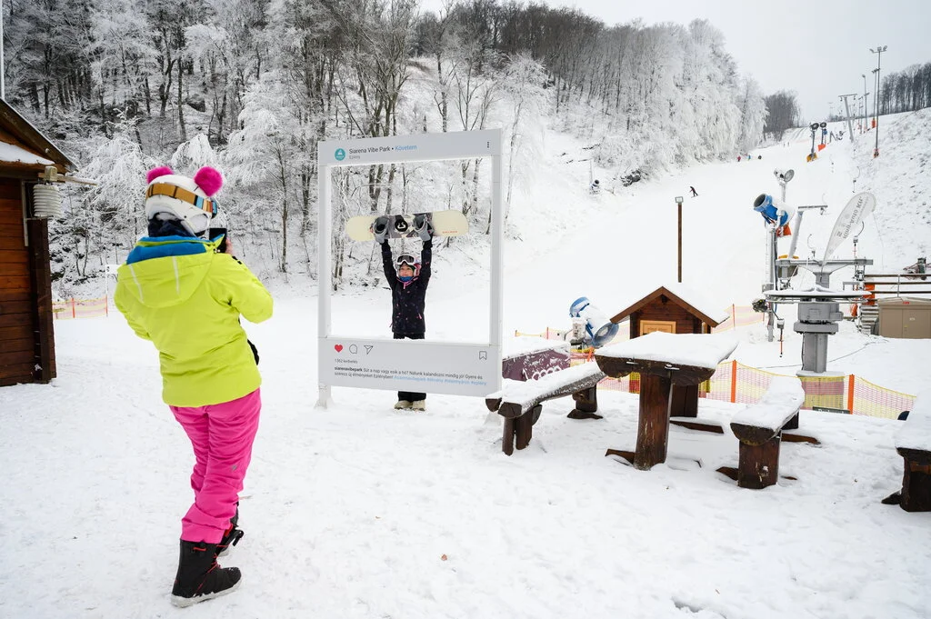
Index.hu wrote this afternoon that many people travelled to the Mátra this morning, resulting in traffic jams on the minor roads leading up to the mountain. The good news is that the ski park in Mátraszentistván opened this morning.

Snowfall was not serious today in Hungary, 1-2 cm fell in the upper regions of North and West. Since the temperature did not go below the freezing point that melted almost immediately. The exceptions are the mountainous regions where locals and tourists can experience a real winter.

On the KékestetÅ‘, Hungary’s highest peak (1014m), the snow is 37 centimetres. Although the ski slopes are closed, there are a lot of people wandering in the white paradise.

Sledges out:

Below, you may check out the snow layer in Hungary now. According to the map, provided you want to build a snowman or wander in a thick layer of snow, you should go to the Zemplén, Bükk, Mátra, Börzsöny and Budai mountains:

Bánkút is also closed, but the snow is 38 centimetres. Here is a drone photo:

Sunset in the Bükk mountain:

And this is Harka, Győr-Moson-Sopron county, on the other side of Hungary, near the Austrian-Hungarian border:

Sopron:

And Szeged:

Yesterday afternoon somewhere in the Gödöllő hills, not far from Budapest:

Based on the weather forecasts, we may expect sunny periods on Sunday, but there will be no significant precipitation. The temperature will be between -6 and -1 degrees at night and +1 and +5 °C in the afternoon.

Monday will be colder, according to idokep.hu. In the Western parts of Transdanubia, the temperature will be between -5 and -7 °C. However, in the North, in windless places, it will go below -10 degrees.

On Tuesday and Wednesday, spring will be back in Hungary, with temperatures around 10 degrees. But on Thursday, winter will come back with mild snowfall and snowstorms.

World-famous Hungarian honey in danger!

Hungarian honey

Bees thought that spring had arrived, but now they have to deal with the minuses since the real winter weather regained the Carpathian Basin. Moreover, Hungarian honey producers struggle with the invasion of mites, too. Below are the details.

According to napi.hu, the milder winter in Hungary affected the honey producers significantly. Bees started to brood in January, which is quite natural when warmth returns but unusual in this month. Of course, 2023 was not the first mild winter in the last few years.

However, if minuses arrive again – as the weather turned quite wintery these days – bee families might be in danger. If they do not end brooding they will lose their food sources and die.

The chairman of the Hungarian association of honey makers, Péter Bross, told public broadcaster Kossuth Rádió that bees would remain active until the sun is shining and the temperature is high.

In October, the bee families should be resting. Instead, last year, they were active and collected pollen. That was not a good sign because it is hard for them to transform the pollen they found then to their winter food source, i.e. honey. Besides, storing that pollen needs time, Mr Bross added.

He highlighted that the first frost has an extremely important task: it destroys the flowers and flowering plants, so bees no longer get pollen.

József Nyerges, a honey maker from Székesfehérvár, regards the changing weather as the most challenging hardship. In the last few years, winters have been warm and snow-free. But low temperatures can follow the mild winters in March, which can decimate the bee families. Moreover, recently acacias regularly froze down in March because of the unexpected cold. If the winter is not favourable for the bees, their loss might reach 20-30 percent.

However, honey makers can prepare for the winter. If they store enough food for the cold season, it can happen only in extreme situations that bees need additional sugar cake for nourishment.

But nowadays, bees in Hungary must cope with the big Asian mite, as well. Mr Nyerges says that they worsen the situation. The mites hide, and you can only reach them with chemical insect killers if the brooding of the bees ends. Therefore, honey makers cannot solve that problem now.

Minus temperatures are coming to Hungary: frosty start in the morning – weather forecast

budapest tram 2 winter

Even though we are halfway through winter, the coldest season has not really shown us minus temperatures. Well, it will now! Get your scarves and gloves ready.

Friday, 27 January

On Friday, clouds will first decrease from the northeast, then increase again from the south, ripost.hu reports. In the south of the country, snow, sleet and drizzle will develop sporadically. The wind will be strong from the northeast and north. In the morning, it will be frosty throughout the country. In the afternoon, temperatures will be only slightly above zero.

Saturday, 28 January

On Saturday, further light snowfall, sleet and possibly snow showers are expected in the south of the country. The chance of sunshine will increase towards the north. Winds will be strong from the northwest. Highs between 0 and +5 degrees.

Sunday, 29 January

On Sunday, clouds will continue to decrease from the north. Several hours of sunshine are possible. In the morning, temperatures will be between -5 and 0. In the afternoon, it will between 0 and +5 degrees Celsius, koponyeg.hu reports.

Monday, 30 January

It will be mostly cloudy with moderate to heavy clouds. Mainly in the second half of the day, snow showers, light snowfall and sleet may occur sporadically, especially in the western and southwestern parts of our country. Winds from the southwest and west may become stronger in many places, met.hu writes. Temperatures will rise from -6 to -1 degrees Celsius in the morning to between 0 and +5 degrees Celsius.

Tuesday, 31 January

Cloudy periods with longer and shorter sunny spells are expected. Occasional showers and snow showers are possible. Northwest winds will increase over a large area, with gusty gusts possible in the lowlands. Temperatures will rise from -5 to +2 degrees Celsius in the morning to between 2 and 8 degrees Celsius.

Wednesday, 1 February

Mostly cloudy or overcast skies. Scattered mixed precipitation. Winds from the southwest to northwest will become stronger in places. Minimum temperatures will be between -6 and +1 degrees, maximum between 2 and 9 degrees.

budapest night hotel tourism
Read alsoBudapest ranked 7th best cultural destination in the world by Tripadvisor

Hungary has not had as much rain in January as this year since 1915

rain

The last time Hungary witnessed such a deluge of rainfall in January so far was in 1915, the National Meteorological Service said on Wednesday.

Three times the average amount of rainfall was seen in several places in the country owing to a series of Mediterranean cyclones.

In Budapest, there were a few tenths of a millimeter more rainfall in January 1886 than in January up to the 23rd: 115.6 millimeters, while in January 2022, a mere 2.9 millimeters of rain fell in the capital.

PHOTOS, VIDEOS: The most beautiful and dangerous places in Hungary

Winter Hungary snowfall Lillafüred

Several mountainous regions of Hungary have become dangerous due to the heavy snowfall the last couple of days.

According to blikk.hu, the minor roads leading to KékestetÅ‘, Hungary’s highest peak (1014m) were closed yesterday to the public. The Magyar Közút (Hungarian Roads), responsible for maintaining the public roads in Hungary, said they decided so for the safety of the people.

They said the snow that fell in the higher regions of the mountain contained a great deal of water. As a result, they are heavy and cause tree falls, endangering everybody on the roads. Furthermore, based on the forecasts, more rain, snow and strong wind are expected during the weekend in the Mátra region. The closure will remain in effect until Sunday at 7 pm but does not concern buses.

Here is a video:

According to utinform.hu, roads between Eger-Hollóstető and Miskolc have also been closed because of dangerous tree falls. Police are navigating the traffic there.

According to blikk.hu, many parts of Hungary were exposed to harsh winter weather this morning. For example, in Bánkút, Northeast Hungary, the snow is so thick that it is difficult even to walk. In some places, it even reaches 40 centimetres. Meanwhile, the lower regions in Hungary are still waiting for snow.

Below are some photos and videos.

Snow chaos in the Mátra:

The snow layer is almost 50 centimetres in the Mátra:

Galyatető (Mátra):

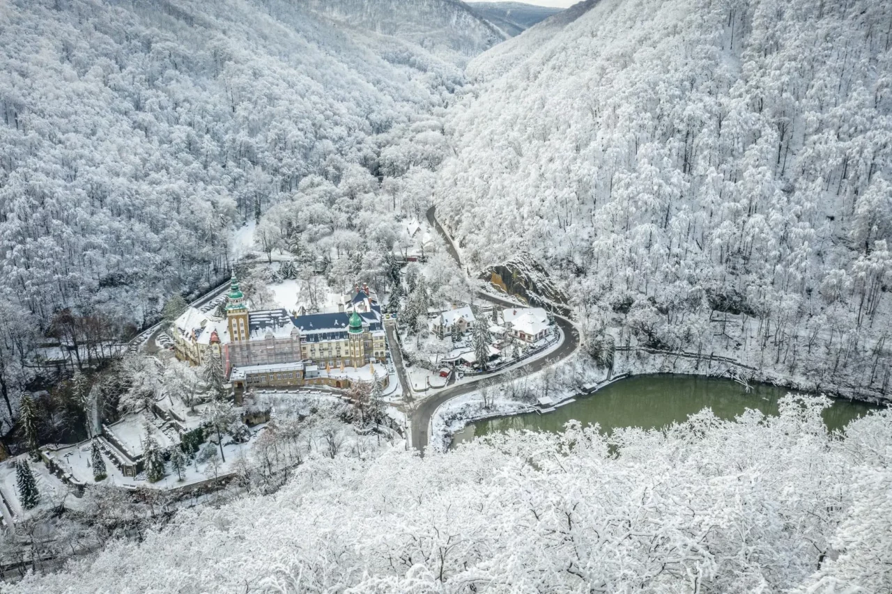
In the Bükk, falling trees cut electric wires. Roads are almost out of use. Police do not allow people to Lillafüred and the Majális Park.

This photo was also taken in the Bükk:

Lillafüred:

Winter Hungary snowfall Lillafüred
Lillafüred today morning. Photo: facebook.com/metkep.met

Snowfall in Zala county:

Watch out! Budapest and other cities may be covered in snow on Thursday

Snow Hungary Budapest weather snowfall

A new Mediterranean cyclone is to bring a lot of precipitation to Hungary. In some parts of the country, snowfall is expected. And as Thursday approaches, the simulations show more and more snow.

Snow to come in Hungary

According to idokep.hu, the most snow is expected in the Transdanubian region of Hungary. However, a thin snow blanket may cover even Budapest tomorrow, the Hungarian meteorology website says in its latest forecast.

The snowfall will start in Transdanubia on Thursday at dawn. Here is a video simulation:

In the Bakony and the Northern mountains, that means a thick snow layer. Furthermore, by morning, many areas and cities will be covered by snow in Transdanubia. For example, a map shared by the website talks about 7-10 centimetres in Pápa, Western Hungary. Furthermore, the snowfall will probably last until late afternoon.

In the Nagy-Hideg-Hegy (Great Cold Mountain, Börzsöny, Northern Hungary), the snow layer may reach 50 cm tomorrow afternoon, idokep.hu highlighted. In Transdanubia, we should expect strong winds able to build snowdrifts.

You should expect snowfall in these areas

According to index.hu, snow might also start to fall in Budapest on Thursday. In Zala, Somogy, Veszprém, Komárom-Esztergom counties and the Danube Bend, the snow will be 5-10 centimetres thick based on the favourable scenarios. The website said that the Hungarian Meteorological Service issued an alert in Nógrád, Veszprém, and Komárom-Esztergom counties for Thursday because 5 centimetres of fresh snow may fall in just 12 hours. Moreover, they alerted the residents of Hajdú-Bihar and Békés counties because of the rain.

HERE is a map about how much snow we can have in the different areas of Hungary tomorrow.

On the map below, you can check out where we should expect snow or rain:

PHOTOS: Thick snow blanket covers Hungarian regions, more snow may come

Hungary snow Kékestető

This January is exceptionally warm in Hungary. Sometimes we feel as if spring had arrived and there would have been no winter. Some may believe that Hungary became a three-season land instead of a four-season country. However, there are some areas in Hungary where snow rules and the thickness of the snow blanket reaches 30-40 centimetres. We brought some delightful photos and a weather forecast for the following days, especially when we may experience snowfall in Hungary.

Currently, the weather is rainy in Hungary. Part of the precipitation falls in a liquid state, but in some other areas, snow rules. According to idokep.hu, we may see the sun on Wednesday in the afternoon. However, in the evening and at night, we should expect rain. In Transdanubia and North Hungary, the precipitation might be snow. In the afternoon, the temperature will be between 4 and 13 degrees Celsius, idokep.hu wrote.

On Thursday, the rainy weather will remain, while in the North and the West, snow may fall.

Here is a map made by the Hungarian Meterological Service (OMSZ). It shows that from tonight and tomorrow night, you should expext snow in West Hungary:

The day will be cloudy. We will only see the sun provided we live in the Southern and Eastern regions. Winds might be strong, while the temperature will remain between 2 and 9 degrees.

On Friday, we should expect rain, snow and sleet with temperatures around 1-5 degrees. Over the weekend, clouds will remain over us, and the temperature will further decrease. The good news is that there will be no considerable precipitation.

Ripost.hu wrote that ski resorts in Hungary would benefit from the snowfall. They have struggled with the lack of it, so most of them closed. However, they added that we should not expect snow later this month. The end of January will be rainy.

Finally, here are some photos from the MetFigyelő Facebook page.

Nagy-Hideg-hegy (Börzsöny). The snow layer is 20-40 cm thick there:

Dobogókő:

The snow is 15 cm on the KékestetÅ‘ (1014 m), Hungary’s highest peak:

Mátraháza, intensive snowfall:

Some photos from Kékestető taken yesterday:

ski resort hungary
Read alsoDo Hungarian ski resorts have a chance for survival?

2022 third hottest year in Hungary since 1901, says weather service

Last year was the third hottest year in Hungary since 1901, the weather service said on Wednesday. Several months were at least 2 degrees hotter than the average of previous years, with the summer mean temperature being the highest since the beginning of the 20th century, the statement said. The national annual mean temperature averaged 11.83 degrees Celsius last year, 1.1 degrees above the average mean between 1991 and 2020.

Most of the hottest years on record have been in the last decade, with warming rising by close to 1.5 degrees since the beginning of the 20th century. Only March, April and September were cooler than the 1990-2020 average, with April being 2.0 degrees cooler. All the other months were at least 1 degree warmer than what would have been considered normal for Hungary’s climate, with February being 3.1 degrees hotter.

The lowest daily temperature in 2022 averaged -11.2 degrees for the country, the ninth highest since 1901, making 2022 the fourth year in a row to have the average minimum temperature be above -12 degrees Celsius. Daily maximum temperatures averaged 17.6 degrees, the second highest behind 2019.

The national summer average high reached 30 degrees Celsius for the first time last year. The hottest day of 2022 was 23 July, with 41.5 degrees recorded in Hódmezővásárhely-Szikáncs and Kiskunfélegyháza, in southern Hungary.

Rain flood
Read alsoHeavy rain and flooding possible in Hungary

Heavy rain and flooding possible in Hungary

Rain flood

The National Meteorological Service has posted on Facebook that heavy rain in the coming days could cause flooding in Hungary.

Heavy rainfall could cause flooding, the National Meteorological Service (OMSZ) said on its social media page. It is already raining in southern Transdanubia and the southern Great Plain, with the rainfall zone gradually moving northeastwards, index.hu writes.

On the Bodrog, water levels may rise to near the level of flood alert level two. According to the OMSZ, the north-eastern third of Hungary is expected to receive the most rain in the next five days. Precipitation could exceed 20 mm.

According to the infographic, 44 mm of precipitation is expected in Debrecen, 39 mm in Szeged and 37 mm in Miskolc between Tuesday afternoon and Sunday afternoon.

“As a result, the northeastern rivers of our country may flood, and according to the National Water Directorate General, water levels exceeding the first level of flood alert are expected in the next six days on the Sajó, the Tárna and the Zagyva, and rising to near the second level of flood alert on the Bodrog”, says the OMSZ post.

Do Hungarian ski resorts have a chance for survival?

ski resort hungary

This winter has brought hardly any snow to Hungary, and this mild weather is also affecting the ski resorts. Due to the higher temperatures, it is difficult for ski resorts to maintain their slopes. For this reason, several of them have been forced to close temporarily. This, of course, has left skiers concerned about the future of the resorts in Hungary.

In order to find out more about the current situation of ski tourism, pénzcentrum.hu contacted Gyula Fehér, chairman of the István Chernel Ski and Tourism Cluster.

How can the remaining ski resorts maintain themselves?

According to Fehér, in recent years, the ski season in Hungary, as well as in the Alpine countries, has been extended. He points out that two years ago, for example, it was still possible to ski until Easter.

In this regard, he particularly stresses the importance of snowmaking and four-season availability. Without these, it is impossible for ski resorts to operate economically on a long-term basis. On the one hand, artificial snow melts more slowly, and the snowmaking equipment can achieve high snow thickness. On the other hand, what four-season availability means is being able to attract tourists with a variety of attractions in both winter and summer.

Chair lifts are great because they allow a four-season use, and they are also environmentally friendly,

he argues.

Is there any reason for concern?

As for the recent particularly mild weather, the expert says this is not the first winter like this. Anyone who runs a ski resort is well aware of the variability of the weather. He also points out that while there are few ski resorts in the country, there are plenty of skiers. This means that when the ski lifts are operating, the resorts are so busy that sometimes it can lead to long lines for the ski lifts. Therefore, when the ski resorts are up and running,

they can operate at quite a high profit, so they can exploit the holes that they have at the moment for instance. Of course, it hurts a lot that there is no snow, but those who run the resorts include this in their calculations.

Although many people were worried about the skiing season already in the fall,

the fear was greater than the actual problem.

In general, Fehér does not see the situation of ski tourism as alarming. Despite the rising energy prices and other factors, there has been significant growth in ski tourism this season globally. As for Hungary, more and more people are skiing here as well. The expert believes that although most people want to go to the Alps or the Tatras, Hungarian ski resorts still remain a popular destination.

PHOTOS: Snow has arrived in Hungary

Snow Hungary sport

According to the meteorologists, January will be much milder in Hungary than usual. That means luck since people will need less energy to heat their homes during a general and global energy crisis. However, many still miss the snow this winter. Now snow arrived in Hungary, covering several mountain tops in the northern and western regions. Below, you can check out some photos.

According to idokep.hu, the air is at the freezing point on several mountain tops, where there is currently snowing. In all other regions in Hungary, rain , and in the southwestern counties, the wind is so strong that it could tear out trees.

A number of mountain peaks are already dressed in white. In Börzsöny, for example, which is 864 metres high, the precipitation turned into snow.

Here are some photos taken by the Nagy Hideg-Hegy Ski and Tourist Centre:

In the Bakony, in Hungary’s Transdanubia, the amount of rain that fell in the last couple of days reached the two months’ average. Meanwhile, on the Hajag-tetÅ‘ (646m), the snow is slowly taking over as the following photos show:

Meanwhile, snow arrived at DobogókÅ‘ and Hungary’s highest peak, KékestetÅ‘ (1014m), as well. Here are some photos:

Nevertheless, in most parts of the country, the weather is mild and much warmer than the norm. Therefore, it is not surprising that snowdrops are blooming in many places:

In the mountains (Bakony, Northern regions, Mecsek and Nagy Hideg-Hegy), Időkép says we should expect snow this week. Furthermore, today we should prepare for strong winds in Hungary as the map below clearly indicates:

Furthermore, in Bakonybél the daily rain record was broken yesterday with 71.1mm in only 24 hours:

The Hungarian Meteorological Service wrote that January will probably remain mild and warm but we should prepare for a good deal of rain this month.

Snowfall to come in Hungary – we will show you where

Snow arrived in Hungary

No snowfall is expected over the weekend in Hungary. However, on Monday snow is forecast in the mountains of the country. In general, however, the weather will remain as in recent days: spring-like and not at all one that is suitable for a January.

Snowfall is not expected for the rest of the weekend in Hungary. Sunday will remain mild for the season, with early spring-like weather in many places. It is worth taking advantage of the milder weather, as precipitation is expected in many places on Monday, Index warns.

On Sunday, the fog will lift during the day due to the increasing southerly winds, but may persist in the north. Sunshine is expected mainly in the south of the country. Temperatures will be between 5 and 8 degrees Celsius in the north and northeast and between 9 and 15 degrees Celsius elsewhere.

Mediterranean cyclone could bring snowfall in the country’s mountains

Early next week, on Monday morning, a Mediterranean cyclone will bring heavy rainfall to our region, with precipitation of over 20 millimetres in places. The cold front on the back of the cyclone will bring a few degrees cooler air. There will be no major changes in the weather, but in the Pilis and Börzsöny areas around the Danube Bend, the air may cool down to near freezing point, so snowfall is expected in these mountain ranges.

On the mountain tops, snowfall is expected on Dobogókő, Csóványos and Nagy-Hideg. Temperatures will also rise to between 5 and 12 degrees Celsius by early afternoon even with strong southerly winds after the morning showers. From the afternoon, the wind will turn north-northwest in the Transdanubian region.

Weather on Tuesday

A cold front will arrive on Tuesday, with rain in the east in the afternoon, and decreasing clouds from the west. Winds will be strong in many areas, gusty in Transdanubia. During the day, temperatures are expected to be between 4 and 9 degrees Celsius. On Wednesday, frost may occur in several places at dawn, but after that, the weather will ease again, according to Időkép.

Hungary border crossing
Read alsoCitizens of 63 countries will soon only be able to enter Hungary with a visa

Exceptional weather to remain in Hungary

Weather Budapest mild

Mild, springlike weather has been ruling Hungary for weeks. And it seems that trend will remain. Meteorologists say there is no sign of a drastic change in the country’s weather. Here is our prognosis, and we also tell you why this exceptionally mild weather is harmful.

Mild, springlike weather remains

According to the Hungarian News Agency, today will be generally sunny, with patches of cloud and possible light showers in places. The lows will be between -2 and +7 °C while the highs between 7 and 12 degrees. Moreover, the wind will also remain moderate today, the Hungarian Meteorological Service (OMSZ) said on Facebook.

On Saturday morning, a cold front may reach the Northeastern counties, where light rains may occur. In other regions, there might be fog with clouds. The latter will only remain in the Northeastern parts. Otherwise, the day will be sunny, with highs between 5 and 11 degrees.

By Sunday morning, fog and clouds will rule greater territories than on Saturday. But the Southern regions will remain sunny during the day with higher temperatures: 10 and 14 °C. In the cloudy Northern parts, that will be only between 4 and 9 degrees.

Below you may find some maps:

In the long run, meteorologists say that Monday will be sunny with stronger winds and temperature between 5 and 13 degrees. A cold front will arrive on Tuesday, resulting in lower daily highs (4-9 °C). Furthermore, on the Transdanubia, winds will become stormy idokep.hu wrote.

Overly mild weather ‘harmful’ to agriculture

Overly mild weather in Hungary is harmful to the country’s agriculture, the National Meteorological Service said on its website on Thursday.

Last week saw unseasonably mild weather and record high temperatures for this time of year in Hungary, with 15 °C recorded over several days in the south-east, while ground frost has been sparse so far this winter, the weather forecasters said, adding that it is expected that mild weather will continue over the next 8-10 days.

Persistently mild weather disrupts the vegetation cycle, it added, and in the absence of cold, pests and pathogens stay relatively abundant, while fruit trees are also endangered as sap circulation has already started; normally frosts slow down and stop this process, whereas in the south-west, hazelnut trees have already started to bloom.

Meanwhile, a large amount of rain is expected next week, and drier soil will be replenished, the forecasters said.

2023 starts with record temperatures in Hungary

thermometer temperature climate change

As expected, the daily national heat record was broken today. In the subtropical air mass from the southwest, temperatures reached highs between 12 and 19 degrees Celsius in the sunniest parts of the country, the National Meteorological Service (OMSZ) wrote on Facebook.

In the end, the highest temperature was 18.9 degrees Celsius in Sellye, which was 1.4 degrees higher than the daily high of 17.5 degrees Celsius recorded on this day last year in FÅ‘nyed, they pointed out. They also noted that about 15 of their stations recorded higher temperatures on Sunday compared to the old highs, 24.hu reports.

In Budapest, the daily temperature record was not broken as it was 0.7 degrees Celsius lower than last year’s 13.7 degrees. The OMSZ added that tomorrow’s national record of 2 January is almost guaranteed, as it is only 16.4 degrees Celsius from 1992.

snowdrop flower spring
Read alsoNew Year brings spring warmth to Hungary: almost 20 degrees on the first day of the year

New Year brings spring warmth to Hungary: almost 20 degrees on the first day of the year

snowdrop flower spring

If we didn’t know it was 1 January, we’d think it was spring in Hungary. You’re unlikely to catch a cold if you go out on New Year’s Eve and toast with a glass or two of champagne in the street.

No precipitation expected

In the northern and northeastern third of the country, the weather may remain cloudy and humid, with only small areas of clouds. Elsewhere, clouds will be variable in thickness, napi.hu writes. No significant precipitation is expected, with drizzle and possibly light rain.

The National Meteorological Service (OMSZ) reports on the weather forecast until midnight on Sunday, stating that the winds from the south and southwest may become stronger mainly in the Transdanubian region, where strong gusts may occur occasionally.

As high as 17 degrees Celsius

The OMSZ also reported that the lowest night temperatures are likely to be between 0 and +5 degrees Celsius. However, windy areas in Transdanubia could see much milder temperatures of around 10 degrees Celsius. Daytime highs on Sunday will be within a wide range, between 5 and 7 degrees Celsius in persistently overcast areas and between 12 and 17 degrees Celsius in less cloudy areas, but warmer in the southwest, according to the OMSZ.

Here is what New Year's Eve looked like
Read alsoPHOTO GALLERY: Here is what New Year’s Eve celebrations looked like in Hungary back in the day

Springlike weather is to come in Hungary on New Year’s Eve

Hungary weather forecast spring

This year’s Christmas did not see snow anywhere in Hungary because a warm, Mediterranean air reached our country resulting in sunny, springlike days and frost-free nights. Now, a colder period will come, but what will the year-end in Hungary look like? Here is the latest forecast.

According to Blikk, a Hungarian tabloid, early-spring weather is expected on 31 December, with temperatures between 10 and 16 °C. The day will be mostly sunny and mild, and only those areas would be colder which are ruled by thick clouds.

Based on the forecast of koponyeg.hu, there will be fog in North Hungary and the Duna-Tisza köze (Danube–Tisza Interfluve) on Thursday morning. Thankfully, it will clear by midday. The Transdanubia will be partly cloudy. Clouds will rule the East and Northeast areas, where humidity levels will also be higher. The temperature will be between 9 and 14 °C.

On Friday, the weather will be cloudy and foggy. Meteorologists expect rains in the South and East. The temperature will be between 5 and 13 °C, but Southwestern winds will get stronger.

On New Year’s Eve, fog will rule the Northeastern and Northern areas of Hungary. Meanwhile, in the Southwestern and Northwestern territories, there will be filtered sunlight. However, the Southwestern winds will be stronger. Despite that, the weather will be mild, while the temperature will be between 10 and 16 degrees, like in early spring. In areas where there are more clouds, it will be colder.

On New Year’s Day, mild weather will endure in Hungary. In the Transdanubia, where clouds will be rare, the temperature may even rise to 15 degrees. Meanwhile, in other parts of the country, where stratus clouds remain, it will be only around 10 °C. HERE you may find a map about what to expect regarding the temperature.

On Monday, the weather’s duplicity will remain. In the Northeastern regions (Miskolc, Nyíregyháza), the weather will be cloudy and rainy, while in the Southwest, we expect sunshine with temperatures around 12 degrees.

On Christmas Day, the historic maximum was almost broken in Budapest. In PestszentlÅ‘rinc, the Hungarian Meteorological Service measured 13.7 °C. That equals the maximum of 2009 measured in Budapest’s downtown then.

Here are yesterday’s maximums:

And the minimums from today morning:

Frost returns to Hungary next week – weather forecast

Budapest Buda Castle Palace winter snow

Although a record high temperature was recorded in Budapest over the weekend, the mild weather will end at the beginning of next week, according to a report by the National Meteorological Service (NMS) sent to MTI. On Monday, it could even be 15 degrees, but a cold front will arrive on Tuesday.

Monday, 26 December

In most places, clouds thin out and break up and the sun shines for several hours, met.hu reports. There is a better chance of persistent cloudy and humid conditions in the north-central mountains, the northern Great Plain and the northwest. Clouds will increase again from the north in the evening. The wind from the south may be strong and sometimes gusty in several places. Daytime highs will be between 8 and 15 degrees in sunny areas and between 4 and 7 degrees in persistently overcast and humid areas.

Tuesday, 27 December

A cold front moving south, southeast, with increasing cloud cover behind it, but mainly in the southwestern counties, cloudy areas may remain. Rain and showers are likely in several places during the first half of the day, with showers becoming more isolated from the afternoon. Overnight lows will be between 0 and +8 degrees, highs during the day between 5 and 11 degrees.

Wednesday, 28 December

The sun may shine in places for longer or shorter periods. At night and in the morning, mainly in the northeast, there may be fog, which may persist in some places. Precipitation unlikely. Winds from the south, southeast becoming stronger in places. Overnight lows will be between -7 and +2 degrees, highs between 2 and 8 degrees.

Thursday, 29 December

There will be sunny and cloudy, humid and foggy areas, and from the evening onwards, clouds may increase in most parts of Hungary. No significant precipitation is likely until the evening. At night, a precipitation zone may move from west to east. Winds from the south and southwest may be accompanied by strong gusts in places. Temperatures could rise from -6 to +2 degrees Celsius in the morning to between 2 and 13 degrees Celsius in the early afternoon, with the southwest being warmer.

Friday, 30 December

Increasingly less cloudy areas from the northwest, but mainly in the northeast and southwestern counties, there may be areas of heavy clouds, fog and mist. A band of precipitation will move southeastwards during the first half of the day, with showers in the second half. Winds from the south and southwest will increase at times, becoming stronger in places. Temperatures will be between -1 and +7 degrees Celsius at dawn, and between 4 and 13 degrees Celsius in the early afternoon, with cooler temperatures in the northeast.

megyeri bridge christmas tree budapest
Read alsoPHOTOS: Budapest bridge turned into giant Christmas trees