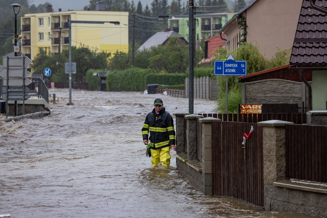
Cyclone Boris also hit Lake Balaton: the Hungarian sea is shifted
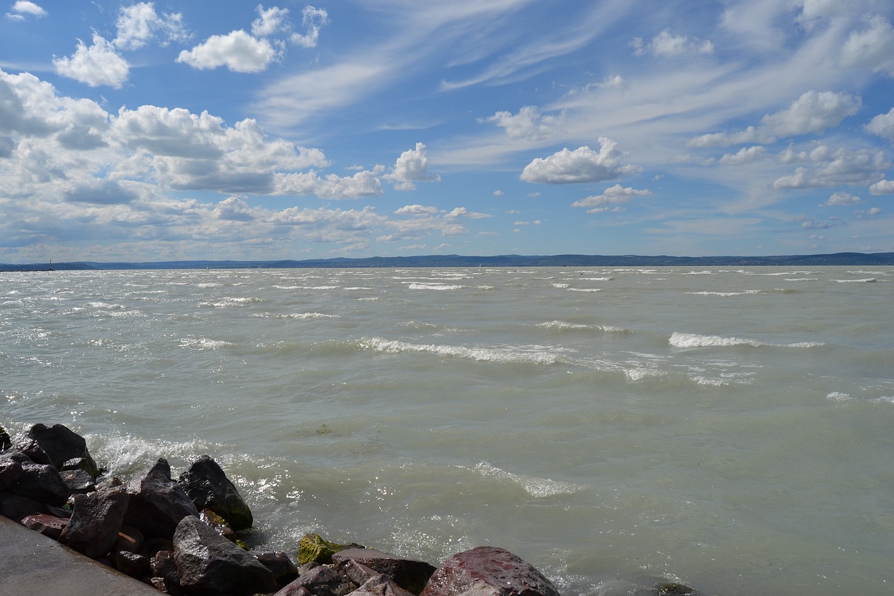
Cyclone Boris not only brought heavy rain, but also high winds and reached the ‘Hungarian sea’.
In Hungary, the settlements along the Danube are most at risk of flooding, but the Somogy county news portal reports that Cyclone Boris has not spared Lake Balaton either.
Extremely strong winds hit Fonyód residents over the weekend, with gusts of up to 130 kilometers per hour measured by Kab Hill instruments. Winds of 105 kilometres were recorded in Siófok and Alsóörs.
The cyclone hit the area with extreme wind gusts and also caused the lake’s water level to shift. Experts measured very different water levels in the two parts of the lake, with the southern side 33 centimeters higher than the northern side. While the water level at Siófok was 109 centimeters as measured on Sunday morning, on the other side, at Badacsony, it was only 76 centimeters.
As we wrote earlier, the Hungarian geological site, near Lake Balaton, was recognised among the world’s most significant, details HERE.
read also:
Budapest mayor: City institutions ready to protect capital from flood
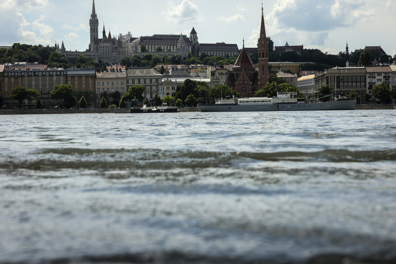
The Budapest city council’s companies and institutions are well-prepared for flood protection work and to protect the capital, Mayor Gergely Karácsony said on Sunday.
Karácsony said on Facebook that the lower embankments on both the Buda and Pest sides of the river will be closed to traffic from Monday evening, and he asked the owners of cars parked there to move their vehicles. A four-kilometre clay dyke will be built along the Romai embankment of the river in northern Budapest, he added.

Karácsony said the city’s Margaret Island will be protected with sandbags, adding that this will be done with the help of machines so no volunteers are needed for the time being. He said the largest flood of the past ten years was forecast to reach Budapest and it is expected to last long because raining continues on the Danube’s water catchment areas.
President wishes much strength for flood protection efforts
President Tamás Sulyok wished “perseverance and much strength to those working for services involved in flood protection, their helpers and volunteers” in a Facebook message on Sunday.
Sulyok highlighted the participation of soldiers and people who are “already fighting a tough battle with the increasing water level”. He added that water management experts forecast record high water levels on the Carpathian Basin stretches of several rivers, and the flooding will soon reach Hungary.
Pintér: Flood protection on Danube, Leitha adequate
The interior ministry is organising the flood protection on the Danube and Leitha rivers adequately, Interior Minister Sándor Pintér said in Győr, in north-western Hungary, on Sunday.
Forecasts indicate that the water levels of the Danube and the Leitha will nearly reach or even exceed the peaks registered in the flood of 2013, Pintér told a press conference, adding that major defence efforts were needed on the two rivers.
The government has instructed the interior ministry to organise the flood defence work, Pintér said. The national disaster management and national water management authorities have marked the areas where the rising water levels can cause emergency situations, such as the need to raise the height of the dams or evacuate the locals, he said.
“I’m convinced that there won’t be any evacuations because we can confine the water between the adequate barriers,” he added. The European Union is also supporting the defence efforts via the Copernicus emergency management service, he said.
The Hungarian Armed Forces has some 17,000 people ready to aid the flood defence work, he said. Pintér also said that the assistance of the public may again be needed just as in 2013, adding, at the same time, that those who decide to help should only go where the disaster and water management authorities ask.
Orbán on flood protection: ‘It will be hard but we will manage’
Prime Minister Viktor Orbán, in a Facebook video on Sunday, said flood protection efforts in Hungary over the coming days “will be hard but we will manage”.
“I’m standing at the Romai embankment in Budapest right now, an area that will be impassable a day from now,” the prime minister said in the video. “By tomorrow, the large mass of water that is expected to arrive will be where my head is right now, and two metres above that in another day or two. But the water management experts are confident because they say the highest water level won’t exceed the record high.”
“They say that if we could handle the highest-ever flood levels then we can handle a lower one as well,” Orbán said. He said the three critical areas were the Szigetkoz island plain in north-western Hungary, the Danube Bend and Budapest. The technical liaison officers are in place and will be the ones helping the volunteers “to make sure that all the goodwill shown by the people in the protection efforts is arranged in a meaningful way”, he added.
The prime minister said all the technical and financial resources needed for the protection efforts were in place. Orbán said Interior Minister Sandor Pinter is in charge of disaster management, adding he was certain that the minister would do a good job handling the flood protection efforts. “And he’s got the government, and — if need be — the prime minister behind him. It will be hard but we will manage,” Orbán added.
Storm uproots trees in Western Hungary
Gale-force winds blowing across Hungary have brought down trees, broken tree branches and damaged power lines west of the Danube, the national disaster management authority (OKF) said on Sunday.
Firefighters responded to more than 170 calls for help on Saturday concerning damage caused by the storm, such as uprooted trees and fallen branches, OKF said, adding that emergency responses continued into Sunday morning. Fallen trees caused delays on multiple railway lines, Mávinform said. Disaster management staff who spoke to MTI’s correspondents made no mention of injuries in any of the counties. In Szombathely, in Vas County, the storm also damaged traffic lights.
Read also:
Attention: Flood alert disrupts international train services, trains between Budapest and Vienna cancelled

The Hungarian railway company, MÁV, has issued a warning to passengers, urging them not to rely on their usual train travel routines and to stay updated on official announcements. The ongoing floods could significantly impact public transportation services.
MÁV warns passengers of changing timetables
The MÁV-VOLÁN group is preparing for emergency measures in response to the flooding, providing continuous updates to the public, Világgazdaság reports. The transport provider advises travellers in flood- and storm-affected areas to closely follow updates through the MÁV website, MÁVINFORM’s Facebook page, the MÁV mobile app, and the Volánbusz website.
The extreme rainfall in Hungary’s river basins poses challenges not only for water management authorities but also for transport services. While rising rivers are the main concern, the intense rainfall, strong winds, and sudden storms are also causing issues such as fallen trees and damaged power lines, potentially leading to disruptions. MÁV personnel are in constant communication with authorities involved in flood management. In case of interruptions to the domestic railway network, replacement buses will be deployed in affected areas as needed.
Train services disrupted in numerous countries
Rail services are already facing disruptions in several countries west of Hungary, with operations halting in certain regions. Although trains are still running between Budapest and Vienna, services west of Vienna are suspended at least until Monday noon.
Should there be any cancellations of international trains between Budapest and Vienna, MÁV-START will arrange alternative domestic trains to cover the route.
On Sunday evening, the Kálmán Imre EuroNight train, which travels from Budapest through Austria to Germany and Switzerland, will operate only within Hungary, between Keleti Station and Hegyeshalom, due to the flood situation.
Starting Sunday afternoon, replacement buses have already been in service along the Komárom–Esztergom line due to the flooding of the Danube, replacing S74 trains. Forecasts suggest that ferries to and from Szentendre Island will be suspended by Tuesday, and Szigetmonostor will be accessible only by bus. In Győr, local buses are already being rerouted due to the closure of the riverside road.
UPDATE: Trains do not commute between Budapest and Vienna
According to information from the Austrian Railways (ÖBB) on Sunday afternoon, ÖBB stopped the train service between Hegyeshalom and Vienna from Sunday at 6 PM until Monday at midnight, and no replacement trains will be available, MÁV said on its website.
MÁV said that all Railjet, Vienna EuroCity, Kálmán Imre EuroNight and EuRegio trains will only run to and from Hegyeshalom. “International passengers, please postpone your journey and do not depart!” – they wrote.
For more information on the measures affecting travel, please visit the ÖBB website or the MÁVINFORM interface. MÁV-Volán has previously announced that flooding and weather disruptions should be expected.
They said that passengers travelling to Austria who had bought their tickets by 12 September for the period 13-15 September would be able to use them between 12 and 18 September. For those planning to travel later, their existing tickets will be refunded or exchanged at no handling charge, Telex reported.
Read also:
- PHOTOS: Budapest braces for flood surge as severe storms hit the region
- Budapest riverbanks to close on Monday evening, mayor warns of prolonged flood
UPDATE 2
16 September, 2024.
Budapest riverbanks to close on Monday evening, mayor warns of prolonged flood

In response to rising water levels on the Danube, Budapest authorities are preparing for serious flooding by closing the city’s riverbanks and reinforcing defences on Margaret Island with sandbags. Mayor Gergely Karácsony has warned residents to expect a significant and prolonged flood, with the capital’s flood defence status raised to the highest alert level starting Monday.
Budapest riverbanks to be closed
In a video posted on Facebook, Mayor Karácsony expressed concern that the upcoming flood could last for an extended period due to continuous rainfall in the Danube’s catchment area.
Starting at 8 PM on Monday, both the Pest and Buda lower riverbanks will be closed to the public.
According to the mayor’s office, the flood alert level will increase to third degree as of Monday, based on updated forecasts. The latest projections suggest that water levels could rise by one meter per day in Budapest, with the river potentially cresting above 8 meters by midweek.
Given the severity of the situation, Mayor Karácsony announced that as of midnight on Monday, flood defences will be ramped up citywide. The city’s flood management team will implement a number of measures in response to the rising water.
Among the planned actions, the Budapest Sewage Works Company (Fővárosi Csatornázási Művek, FCSM) will close flood barriers along Nánási and Királyok roads and construct a four-kilometre-long clay embankment, standing one meter tall and four meters wide. As a result, Királyok Road will be closed to traffic starting Monday, Economx reports.
On Margaret Island, lower-lying areas will be fortified with sandbags, with high-powered machinery brought in to assist. If necessary, authorities may also close the island entirely to both vehicles and pedestrians later in the week.
Floodwaters are expected to reach the lower riverbanks on Tuesday, 17 September. Sections of the Pest embankment, already closed for a weekend event, will remain shut until floodwaters recede. Additionally, the entirety of the Pest and Buda lower riverbanks will close from 8 PM on Monday. From midnight on Saturday, parking along the riverbanks will be prohibited, with any remaining vehicles towed away by the city’s enforcement agency on Monday.
Public transportation in flood-prone areas along the river could also be affected, with further details to be announced early next week, depending on how the situation develops.
Read also:
- PHOTOS: Budapest braces for flood surge as severe storms hit the region
- Attention: Major flood protection alert declared in Budapest amid rising Danube levels, roads closed
UPDATE
16 September, 2024.
PHOTOS: Budapest braces for flood surge as severe storms hit the region
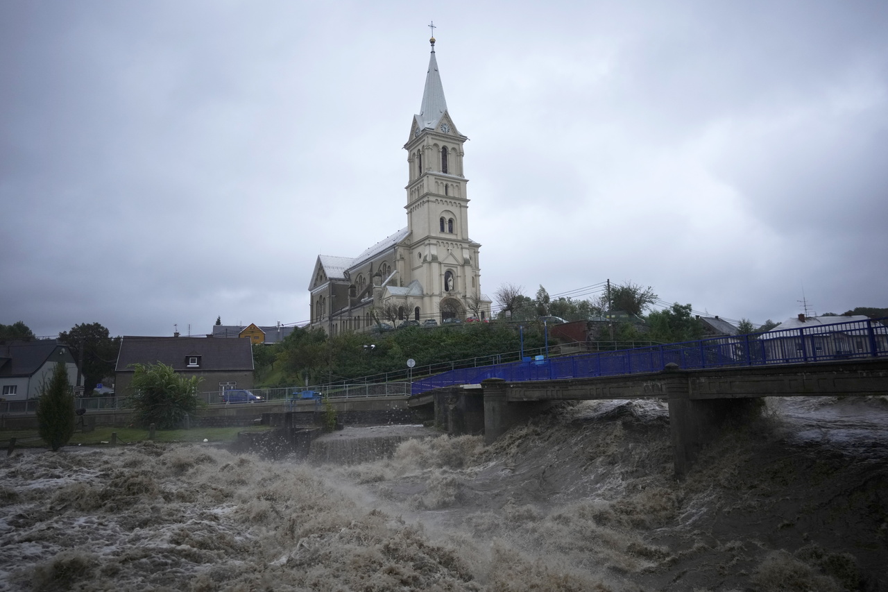
Budapest is preparing for a significant flood surge, with the Danube’s water levels expected to rise dramatically in the coming days. According to the National Water Forecasting Service (Országos Vízjelző Szolgálat), starting Monday, the river’s water level will increase by roughly one meter per day, surpassing 800 cm by midweek. Current data shows the river’s level at 250 cm, and it’s predicted to reach as high as 850 cm, potentially triggering third-degree flood alerts. For comparison, the highest water level ever recorded was 891 cm.
Budapest to see restrictions due to the flood situation
Given these projections, authorities are considering closing off Margitsziget (Margaret Island) to both pedestrian and vehicle traffic, Portfolio reports. The lower embankment of the Pest side will likely be submerged by 17 September, while other sections, including the Buda side, will be closed from 8 PM on 16 September.
This surge comes after days of severe weather across Austria and parts of Central Europe. Heavy rainfall has caused significant flooding, particularly in Lower Austria and Burgenland. The storms have now reached western Hungary, prompting the Hungarian Meteorological Service (HungaroMet) to issue an orange alert for Sunday, warning of wind gusts reaching 110 km/h in some areas, Portfolio writes in another article.
Flooding in Austria
In Austria, the Lainsitz River has overflowed, flooding roads and disrupting train services between Amstetten and St. Valentin. Vienna has also faced challenges, with partial closures on metro lines due to water entering tunnels. Emergency evacuations are underway, and the Austrian army has been deployed to assist, Die Presse reports.
Es ist soweit: Erste Flüsse in Niederösterreich überschreiten nun die 30-jährliche Hochwassermarke – etwa die Lainsitz im Waldviertel.
Und die kommenden 48 Stunden bringen gerade im Osten noch einmal extreme Niederschlagsmengen.
(Bilder: Stadtgemeinde Weitra) pic.twitter.com/ZfekYSLqPt— wetterblog.at (@wetterblogAT) September 14, 2024
Although forecasts indicate a reduction in rainfall over the next few days, strong winds continue to hinder recovery efforts in Austria. Winds in some regions have reached speeds of 121 km/h, particularly in higher elevations such as the Rax mountain station.
The situation in Czechia
In Czechia, tens of thousands of people are being evacuated due to flooding. Nearly 3,000 people are leaving their homes in the Moravian-Silesian region, with thousands more evacuated from Opava. Both the Moravian-Silesian and Olomouc regions have declared states of emergency, and four people are missing due to the floods, according to Hospodarske Noviny.
Heavy rain continued overnight into Sunday, and forecasters warn that the combined water flow in areas such as Jeseníky, Krnov, and Opava may exceed levels seen only once in a century. Southern Bohemia is also facing severe conditions.
Sunday’s forecasts predict less rain than today, but in the Jeseníky Mountains, up to 80–100 mm of rain could still fall, according to Environment Minister Petr Hladík. The bad news is that more rain is expected on Monday, he added.
In Hungary, authorities advise residents in affected areas to avoid travel until conditions improve.
Read also:
- Attention: Major flood protection alert declared in Budapest amid rising Danube levels, roads closed
- Exceptional rainfall expected to affect the Danube in Austria and Hungary in the coming days
UPDATE
16 September, 2024.
Orbán cabinet claims they are ready for the overwhelming flood approaching Hungary – VIDEO

Prime Minister Viktor Orbán on Friday visited sites along the River Danube at the border of Budapest and Pest County to check flood protection preparations after recent heavy rains, his press chief said.
Bertalan Havasi said Orbán had been briefed by water management experts and Energy Ministry officials in charge of flood protection about projected water levels and necessary measures for the whole of Hungary.
Hungarian army prepared for flood protection, says minister
The Hungarian army stands ready to help with flood protection operations if need be, Kristof Szalay-Bobrovniczky, the defence minister, said on Friday. According to the meteorological services, heavy rains between 50-220 millimetres are expected to trigger floods on the Danube, Mura, Lajta and Raba rivers in Hungary, Austria and Czechia over the next couple of days.
The army’s units assigned to participate in flood defence were put on alert and started conducting drills on Friday morning and the necessary communication channels with regional defence committees have been activated, defence minister said in a statement.
We’re prepared, says Orbán in a Facebook post:
It cited army chief Gábor Böröndi as saying that in line with the disaster management action plan, the army was ready to respond fast and effectively contribute to flood protection operations by ensuring personnel and technical conditions.
“Our resources including land and areal technical equipment will provide for the public’s protection,” he said.
Flood alert issued for Budapest
Based on forecasts by the national water-level service, Gergely Karácsony, the mayor of Budapest, has issued a second-degree flood alert along all flood protection sections of the River Danube in the capital, the mayor’s office said on Friday. The lower embankment of the Danube is expected to be closed to traffic from next Monday, the statement said. Starting from midnight on Friday, parking will be prohibited in the area, it added.
The Danube’s water level is expected to peak at around 8 metres in the second half of next week, the statement said.
Weather forecast for Saturday
Generally overcast and rainy with stormy winds in places. Lows: 6, 13 °C. Highs: 10, 17 °C.
Read also:
- Exceptional rainfall expected to affect the Danube in Austria and Hungary in the coming days – read more HERE
- The most horrid floods in Hungarian history
Odd sight: Hungarian M35 motorway foaming after a morning rain – PHOTO
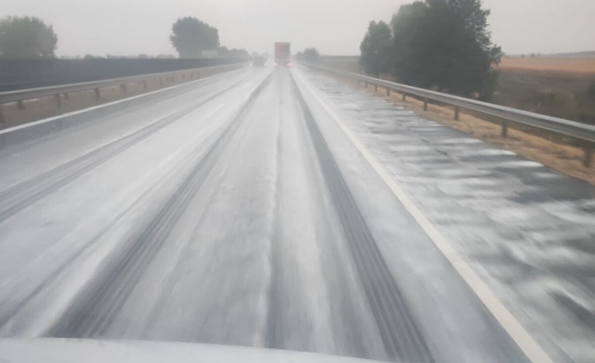
An unusual sight greeted locals on Wednesday morning following heavy rain. The surface of the M35 motorway was covered in a frothy, white foam. Was this caused by hazardous chemicals, or is it a natural phenomenon?
Odd occurrence on the M35 motorway
Local media HAON reports that on Wednesday morning, frothy white liquid was seen flowing over the M35 motorway near Debrecen, covering the road surface, according to reports from nearby villages. Various theories have emerged regarding the cause of the unusual phenomenon. The Hungarian Concession Infrastructure Development Plc clarified that the liquid resulted from freshly paved asphalt, as certain elements of the mixture take time to fully absorb. They explained:
After new asphalt is laid, some elements of the asphalt mix may take time to be fully absorbed. During heavy rainfall, it is not unusual for these materials to mix with the rainwater, becoming thick enough to start foaming when churned up by the wheels of passing vehicles. The additives we use comply with all current regulations and are used in accordance with the relevant specifications.
However, some locals believe that the foaming is a natural occurrence caused by the accumulation of dead unicellular organisms, algae, and seaweed.

Read also:
Weather takes a turn in Hungary: Brace for cooler temperatures and rainy days ahead

On Sunday, we can expect mostly sunny skies in Hungary with some scattered cumulus clouds and occasional showers. Temperatures will range between 29 and 34 degrees Celsius (84 and 93 degrees Fahrenheit). However, from Monday onwards, rain will move in from the west, bringing some relief from the heat.
Sunday morning will see mostly clear skies, with only a few areas experiencing cloudiness, and no significant rainfall is anticipated. Throughout the day, expect a mix of sunshine and scattered cumulus clouds, Pénzcentrum reports.
In western Hungary, more cumulus clouds will form, with some areas experiencing temporary cloud cover and the possibility of a brief shower. By late Sunday afternoon, the sky will gradually become more overcast, with thickening high clouds, leading to a mostly cloudy or overcast evening in the western regions.
A southerly to southeasterly wind will occasionally strengthen in the North Transdanubia and central parts of the country. Overnight temperatures will generally range from 15 to 21 degrees Celsius (59 to 70 degrees Fahrenheit), though cooler spots may experience lower temperatures. The highest temperatures on Sunday are expected to be between 29 and 34 degrees Celsius.
On Monday, rain will begin moving in from the west, and temperatures will continue to drop throughout the week.
Read also:
- Heatwave at school start: 35-39 ℃, 95-102 ℉ inside classrooms?
- Hungary has never seen a summer this hot: Here are the facts
Featured image: depositphotos.com
Heatwave at school start: 35-39 ℃, 95-102 ℉ inside classrooms?

Péter Magyar, who heads the opposition Tisza party, has sent a letter to the government official in charge of public education, asking what was being done to improve “intolerable and inhuman” conditions in Hungary’s schools.
In the letter to Zoltán Maruzsa, seen by MTI on Wednesday, Magyar asked whether the entreaties by teachers and children in connection with hot classrooms had reached the state secretary. In several schools, temperatures in the classroom had reached 39 ℃, the letter said. He also cited the example of a school that had been without running water for months.
Magyar raised concerns about the impact on the health of students and teachers of sustained temperatures of 35-39 ℃.
The autumn heatwave in Hungary will last at least until next week, meteorologists said.
Hungary sees new heat records in September
On the third day of autumn, several heat records were broken, HungaroMet said on its website on Wednesday. On János Hill in Budapest, the mercury dropped to only 22.7 degrees ℃ at dawn on Tuesday, breaking the national and capital’s dawn heat record for that day. In 1956 Pannonhalma, in western Hungary, held the national record until then, with 22.1 ℃ measured.
In Körösszakál, Tuesday saw a new daytime record of 36.5 ℃, when previously on this day 35 ℃ was recorded in 1929 in Szerep and in 1944 in Békéscsaba. At Budapest’s Ujpest weather station, a new daytime record of 35.1 ℃ was measured, beating the 34.5 ℃ level seen in 1949 at the Budateteny station.
Government aiming to take all school children to national or historic memorial sites
The government is expanding its remembrance education programme to take all Hungarian school students to a historic national memorial site at least once, the deputy prime minister said on Wednesday.
The initiative would reach some 78,000-80,000 students in the 7-11th grade, in some 3,000 classes, who will visit one of 47 national memorial sites, Zsolt Semjen said. for the project, he added.
The 1 billion forint (EUR 2.5m) scheme which brings together history lessons, good practices of teaching remembrance at the historic sites and team building in classes will be reviewed after a year. If successful, the government will pursue it further, he added.
Teachers receiving ‘biggest wage increase of all time’ in Hungary?
Teachers’ pay is almost doubling and the scale of the rise is unprecedented in Hungary, a government official said on Wednesday. From Jan 1, teachers’ wages have been raised by 32.2 percent, and a further rise of 21 percent is scheduled from next year, Bence Rétvári, the interior ministry’s parliamentary state secretary, told a press conference, adding that their salaries have risen by 10 percent each year over the past two years.

Over the space of four years, their pay will have risen by more than 93 percent during a single parliamentary cycle. Domestic and EU funding has paid for the wage increase, with about 8 percent of EU funds and the rest used for this purpose until 2030, Retvari said, adding that the EU component got the ball rolling sooner.
The government considers it important to show that teachers are recognised socially, morally, and financially, he said. New career rules adopted by MPs also encourage young people to choose the teaching profession as it will be possible to earn a relatively high salary “even at a young age”, he said.
Read also:
Hungary has never seen a summer this hot: Here are the facts

Two of the three hottest months in the past 123 years have occurred this summer since temperatures have been officially recorded in Hungary. It is, therefore, no surprise that the seasonal temperature record has been broken. Alarmingly, this summer was nearly 3 degrees hotter than the average of the past three decades.
Summer, 2024
June was already warmer than usual, but the last two months of summer were exceptionally hot. This summer also saw the longest and most intense heatwave on record, breaking the seasonal temperature record for the second time in three years.
Daily data shows that August’s average temperature was nearly the same as July’s. As previously reported by Hungaromet, July was only a hair’s breadth away from being the hottest month in 123 years. This time, the record might well be broken.
The numbers
Daily data shows that August’s average temperature was nearly the same as July’s. As previously reported by Hungaromet, July was only a hair’s breadth away from being the hottest month in 123 years. This time, the record might well be broken.
- The average summer temperature between 1991 and 2020 was 2.6 degrees lower than in 2024. The upward trend is evident, as the five hottest summers since 1901 have all occurred after 2000, with three of them in the past six years.
- According to initial calculations, the average temperature in August was 24.45 degrees Celsius. This is 0.04 degrees Celsius higher than the figure calculated from the same data set one month earlier. Based on final figures, the average temperature in July was only 0.01 degrees Celsius below the historical record, which explains how this record-setting month came about.
Records are falling one by one
This summer’s record also means we have experienced an entire year in which every season has set a new warmth record. This pattern was observed last autumn, continued through winter, and persisted into this spring.
The average temperature over the past 12 months was 13.5 degrees Celsius, nearly 3 degrees above the average for the 30 years between 1991 and 2020, despite those decades not being particularly cold in Hungary.
It is also worth noting that there were 28 days of heat warnings issued during the summer, with five more in early September. However, this number could have been seven days higher, as the national average temperature exceeded 25 degrees Celsius on 35 days in the three months leading up to 31 August.
What can we expect?
September, the first month of autumn, has also begun with a heatwave. The heat warning is currently in effect until 5 September. suggesting we can expect average daily temperatures of over 25 degrees Celsius for the next few days.
Read also:
- Heatwave in Hungary peaking, 120-year-old record will probably break
- Saturday marks 4th consecutive day of record-high early-morning low temperatures
Featured picture: depositphotos.com
Tension rises as storm looms over Budapest: Fireworks show in jeopardy

As expected, HungaroMet has issued an official weather alert, warning that heavy thunderstorms are approaching Budapest, according to Zoltán Kovács, head of the task force responsible for ensuring safety during the 20 August national holiday.
Kovác shared the update on his Facebook page late Tuesday afternoon. The decision on whether the fireworks display, scheduled for 9 PM, will proceed or be cancelled has not yet been made. Meanwhile, the storm has already hit north of the capital, bringing hail with it, Portfolio reports.
There are still many uncertainties regarding the evening weather, so the final decision on whether to hold or postpone the fireworks will be communicated later.
Kovács urged everyone to take weather alerts and warnings seriously, advising people to seek shelter if necessary.
HungaroMet issued the severe weather warning earlier this afternoon. At 4 PM, the meteorological service highlighted the primary danger for today as heavy rain, but also noted the possibility of hail and high winds.
According to Időkép, the storm has already been raging in Vác, where hail fell for 10-11 minutes. Parts of the city have been flooded due to the sudden downpour, with water reaching knee height in some areas, as the drainage system couldn’t handle the volume.
Background
Earlier in the afternoon, the state secretary announced that, in light of public safety concerns, the task force will be making hourly decisions on whether the Budapest fireworks show will go ahead. He described the weather situation as highly unusual, with significant atmospheric instability. Forecasts suggest the likelihood of showers and thunderstorms, yet the sun is shining brightly, and the public events are drawing large crowds.
“We still cannot predict the exact conditions for the evening, which is why we’ve decided to evaluate the situation hourly. Keeping public safety and event security in mind, we will continue to inform the public of any developments,” the state secretary stated.
Read also:
- Downpour warning issued: Will the spectacular firework show on 20 August be cancelled?
- Hungary prepares for Europe’s largest fireworks display on 20 August in Budapest – Here are the details
Featured image: depositphotos.com
Saturday marks 4th consecutive day of record-high early-morning low temperatures

Record high early-morning temperatures were recorded for the fourth day in a row on Saturday, when a weather station in Pécs, in southern Hungary, measured 27.7 degrees Celsius (81.86 °F), the national HungaroMet weather service reported on Sunday.
The highest early-morning temperature that day so far, 24 degrees (75.2 °F), was measured in Berettyóújfalu, in eastern Hungary, in 1952.
Saturday also saw the maximum temperature record for the day broken. A weather station in Baja, in southern Hungary, measured 40.4 degrees (104.72 °F). The earlier record temperature measured on this day was 37 degrees (98.6 °F), measured in Baja and Kübekháza in 2022.
Read also:
Will the rain wash away the 20 August celebrations? Rainstorms expected

According to HungaroMet’s forecast, thunderstorms are likely at any time in the coming days, which is not particularly good news, especially since Hungary’s 4-day-long 20 August national holiday is starting.
Monday, 19 August
According to HungaroMet, on Monday, cloud cover will be variable with some breaks, but generally, there will be plenty of sunshine. While the chance of precipitation decreases in the morning, it will increase again in the afternoon. Showers and thunderstorms are expected mainly in the Transdanubia region and the North Hungarian Mountains, potentially occurring in multiple waves. Rainfall chances will diminish as the weather moves southeast.
Northern winds will be brisk to strong in Transdanubia for most of the day, with temporary stormy gusts around thunderstorms. Daytime temperatures are expected to range between 29 and 36 degrees Celsius, with even higher temperatures possible in the Southern Great Plain.
Tuesday, 20 August
On Tuesday, the weather will feature a mix of cumulus and cirrus clouds with plenty of sunshine. Isolated showers and thunderstorms may occur. The northern and northeastern winds might strengthen, with gusts reaching stormy levels during thunderstorms. Morning temperatures will range from 14 to 24 degrees Celsius, rising to 28 to 36 degrees Celsius in the afternoon, with the warmest temperatures in the southeast.
Wednesday, 21 August
Wednesday will see a lot of sunshine with cumulus and cirrus clouds. Showers and thunderstorms may occur locally. The northern and northwestern winds will be lively, occasionally strong, with stormy gusts possible in thunderstorm areas. Temperatures will rise from 16 to 24 degrees Celsius in the morning to between 30 and 36 degrees Celsius in the afternoon.
Read also:
- Where to shop during Hungary’s 20 August long holiday
- Major traffic disruptions in Budapest for 20 August celebrations
Featured image: depositphotos.com
Record high temperature measured in Hungary

Record high temperatures were measured in southern Hungary on Wednesday and also on Thursday morning, breaking the national records for the day, the weather service said.
HungaroMet said on Facebook on Friday that even in the coolest hours of the morning, the temperature did not drop below 25.6 degrees Celsius at a measuring station in downtown Szeged, in southern Hungary, on Thursday morning.
The previous record on that date was 25.2 degrees, in Farkasgyepű in 1952.
Read also:
- Beware! “Code red” heat alert remains in Hungary!
Beware! “Code red” heat alert remains in Hungary!

A “code red” heat alert has been extended until midnight on Sunday, a state secretary of the interior ministry told a press conference on Friday.
Under the measure, all welfare institutions are obliged to open up for the homeless, Attila Fülöp said. Under such extreme weather conditions “all welfare services must focus on saving lives”, he said. He added, however, that only 77 percent of beds at homeless shelters were occupied, and noted the remaining capacity.
Cecília Müller, the chief medical officer, warned that infants, the elderly, people with cardiovascular or other chronic problems were also at risk in the heat wave.

Daytime highs in Hungary are expected to peak in the 37-39 C range in
the coming days.
Read also:
Danger of heatstroke high today: records may break, drought rages in Hungary – UPDATED

A third-degree heat alert has been introduced from today until Sunday. Today, the danger of heatstroke is high, so you should be cautious.
According to index.hu, Wednesday will be hot. In the country’s Southern regions, the thermometers may show even 41 degrees. Therefore, in Csongrád-Csanád and Bács Kiskun counties, the highest third-degree heat alert is in effect.
Today’s morning minimum was between 18 and 24 degrees in Hungary. The day will be cloudless but windy, and there is a chance for showers and rainstorms due to the high temperature.
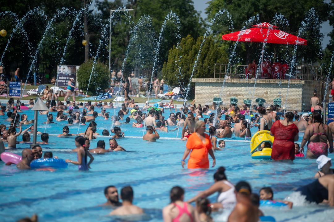
The daily maximum will be between 33 and 38 degrees, but thermometres may show 40 or 41 degrees in the South.
Hungary in red on the maps of the Hungaromet:
People sensitive to warm weather may experience headaches, tiredness, and blood pressure shifts, which increases the possibility of cardiovascular catastrophes like stroke and aneurysm. The danger of heatstroke is high.
Between 10 AM and 4 Pm, UV radiation will be significant.
Drought damages Hungarian agriculture
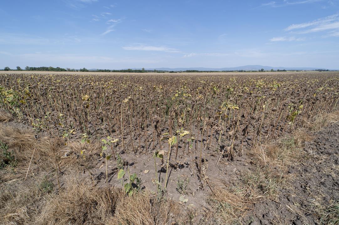
The damage caused to Hungarian agriculture by drought in July and August may reach HUF 350 billion (EUR 888 million), telex.hu wrote. For example, the yield of corn and sunflower is dropping. György Raskó, a Hungarian agriculture economist, said the prices would not rise because the European market is open and the Ukrainian grain is here. Interestingly, the Hungarian government allocated only HUF 35 billion (EUR 88.8 million) to compensate the Hungarian farmers.
UPDATE: Tuesday average 8 °C hotter than usual
Tuesday’s temperature was on average 8 degrees Celsius hotter than usual on this date, in some places even 10-11 degrees hotter, the weather service said. HungaroMet said on Facebook on Wednesday that around 35 degrees was measured in several places in southern Hungary in the morning hours of Tuesday. The hottest temperature recorded on Tuesday was 40.7 degrees in Kelebia, which was a record high. At night the temperature did not drop below 27 degrees in the city of Pecs. Only in north-eastern Hungary was the morning temperature cooler.
Read also:
- Hungary experiences the hottest and 7th driest July on record in 2024 since 1901
- Heat record was broken on Tuesday, fire ban still in force in Hungary – details in THIS article
Heat record broken on Tuesday, fire ban still in force in Hungary

A heat record temperature of 40.7 degrees Celsius was measured in Kelebia, in southern Hungary, the HungaroMet weather service said on Facebook on Tuesday.
Heat record broken in Hungary
The highest temperature measured on August 13 before today’s record was 39.8 degrees recorded in 1946 in Kaposvár, in southern Hungary, HungaroMet said.
Meanwhile, the chief medical officer has declared the highest, third-degree, heat alert to be in effect from Tuesday midnight until Sunday midnight, the disaster management authority’s directorate said on its website.
Risk groups include young children, the elderly, pregnant women, and people with cardiovascular disease as well as house pets.
The public is advised to drink water more frequently and avoid direct exposure to the sun from noon until early afternoon.
In light of the heat wave and the recent dry period, a fire ban is still in force in Hungary’s entire territory, the authority said.
Daily highs are expected to be between 36 and 38 degrees, at 40 degrees in places, over the next several days, according to forecasts.

Read also:
Prepare for extreme heat tomorrow in Hungary: Temperature above 40 degrees Celsius

The extreme heat will carry on tomorrow in Hungary. In certain parts of the country, the temperature will exceed 40 degrees Celsius. We advise you to stay at home if you can and protect yourself from the harmful UV radiation.
Extreme heat on Tuesday
As 444 writes, the sunny and dry weather will stay in Hungary. Monday night will see lows between 17 and 22 degrees Celsius. Meanwhile, on Tuesday, temperatures will be between 32 and 37 degrees Celsius. However, some places in the Southern Great Plain could see the mercury rise close to 40 degrees Celsius.

How to stay safe
In extreme heat, it is crucial to stay hydrated by drinking plenty of water and avoiding caffeine or alcohol, which can dehydrate you. Wear light, loose-fitting clothing, and stay indoors during peak temperatures, typically between 11 AM and 3 PM. Be vigilant for signs of heat-related illnesses, such as dizziness or nausea, and seek medical help if necessary.
Read also:


