Budapest public transport disrupted by Danube flooding, roads closed in the country

Tram no. 2 in Budapest is not running due to the flooding of the Danube, and several roads in the country are closed.
Due to the high water level of the Danube, tram no. 2 between Széchenyi István Square and Boráros Square and trams no. 2B and 23 between Jászai Mari Square and Boráros Square are not running in Budapest, BKK Info announced on its Facebook page on Wednesday. The transport company recommends using trams no. 4 and 6, bus 15 and the metro.
On Tuesday, the Budapest Police Headquarters issued a warning that due to the rising water level of the Danube, it is dangerous for pedestrians to stay on the closed Buda and Pest Lower Quays. The Buda and Pest Lower Quays have been closed to vehicle traffic due to the risk of flooding, Telex reports.
BKK Info also shared that instead of tram line no. 2, the light tram will run today on tram line no. 49.
The Danube at Budapest is expected to peak around 680 centimetres on Thursday morning. Water levels are expected to fall below the level of the quay on Friday, 24.hu writes.
In Dunakeszi, the Danube was already at 659 centimetres on Tuesday evening:
According to Útinform, several roads are closed in the country due to flooding:
- In Pest county, the entire road no. 12125 leading to the border at Ipolydamásd was closed.
- In Komárom-Esztergom county, the section of the Esztergom-Country border link road no. 11326 between km 1 and km 2 on the quay side is closed due to the Danube flooding.
- In Vas county, due to the flooding of the river Répce, road no. 8631 Vasegerszeg-Nagygeresd linking road between Nagygeresd and the main road 86 was closed.
- In Nógrád county, road no. 2209 leading to the border bridge at Őrhalom was closed due to the flooding of the River Ipoly.
Yesterday, the Mayor of Budapest, Gergely Karácsony, ordered a second-level flood alert in Budapest. The Buda and Pest Lower Quays were closed to vehicular and pedestrian traffic on Monday.
Read also:
Unbelievable weather to come next week!

Hungary is in for a rather unorthodox Mediterranean Christmas Day, and it seems winter has taken a sabbatical for 2023. According to the Hungarian Meteorological Service, you should brace yourselves for a balmy 14-15 degrees tomorrow!
Daily maximums will remain above 10 degrees even in the second half of next week, index.hu wrote.
Based on the mid-term prognosis of the Hungarian Meteorological Service, a mix of rains, fog and gushing winds are expected in some regions.
On Monday, sunshine will rule some corners of Hungary. No precipitation is expected. The highest daily temperature will be around 10-15 degrees. Winds will pick up from the west.
As we transition to Boxing Day, expect a cloudy affair, though rain is set to skip the celebration. Temperatures at dawn will be just above freezing point, while by early afternoon, they’ll fluctuate between 7 and 14 degrees.
Come Wednesday, temperature will begin to drop, but the daily maximums will remain around 10 degrees. Winds might kick up, but precipitation will be scarce. In the morning, we should expect fog.
On New Year’s Eve, maximum temperature will range between 4 and 12 degrees in Hungary. It seems winter has sent its regrets for 2023 – no frosty days in the cards.
Cheers to a peculiarly mild festive season in Hungary!
Read also:
BREAKING: Delays, cancellations, closed runway at Budapest Airport due to snowfall

Unexpected snowfall surprised Hungary today, one day before Christmas Eve, although weather forecasts talked about spring-ish weather for today and tomorrow. Due to the intensive snowfall at Budapest Airport, there will be cancellations and delays and one of the runways had to be closed.
According to the airport’s official Facebook page, “the heavy snowfall is also affecting Ferenc Liszt International Airport. Due to weather conditions, runway 1 had to be temporarily closed, but the airport is now back to operating with two runways. BUD’s snow clearance fleet is continuously clearing the runways, taxiways and the terminal apron. The ground handling companies are also continuously de-icing the aircraft, but it is taking longer than usual, so delays and cancelations are expected in the coming hours.
Passengers are advised to monitor the status of their flights and, in view of the weather, leave for the airport earlier than usual, to ensure that they arrive at Terminal 2 on time, at least two hours before departure, despite any possible traffic disruptions.”
Read also:
New Ryanair flight announced from Budapest to this European city – Read more HERE
Spring will come in Hungary at Christmas – here is what to expect

Winters have been mild in Hungary lately, so most Hungarians have not seen snow on Christmas Eve for years. However, that might change this year, but the chances are low. Instead, we can expect a rather warm Christmas.
The winter of 2023-2024 started with lots of snow in Hungary. A Mediterranean cyclone brought lots of precipitation and met with Northern cold winds. As a result, the beginning of December saw lots of snow in Hungary, even in the Hungarian Great Plains. Thanks to that, ski centres could open earlier. We collected the best Hungarian ski resorts in THIS article.

According to portfolio.hu, from Friday night, an extensive precipitation zone will reach Hungary, bringing rain, sleet and snow. Based on the weather forecast of the Hungarian Meteorological Services, the snow is not expected to last long because of the high daily average temperature. But there are regions where locals should prepare for a white Christmas this year.
On Friday, snowfall is expected in the Transdanubian Mountains, Budapest and the Northern mountainous regions. From the night, the wind will become more moderate, but it will turn stormy after dawn. The lowest night temperature will be between -1 and +4 degrees.
Chance for a white Christmas low
On Saturday, the sky will be cloudy, and precipitation is expected in multiple places. In the Southern and Southwestern regions, rains will rule the day. In other places, sleet and snow are expected. Northwestern and Western winds will get stormy. In the afternoon, the thermometers will show 1-9 degrees, so it will not be too cold.
Sunday will remain cloudy, and there will be rain in some regions. In the Northern territories and the mountains, snow and sleet might fall instead of rain. Winds will remain stark, but the temperature will increase. At dawn, it will be around -3 and +5 degrees, but in the afternoon, it will rise to 7-12 degrees. According to Időkép, the temperature may even hit 15 degrees in some places.
Unfortunately, there is not much chance of a white Christmas this year. In the Great Hungarian Plains, the chance is 0-10%, which will increase to 10-20% in the higher mountains and the Northern regions.
Read also:
Will Hungary have a white Christmas? – weather forecast for Christmas week

Unfortunately, in most parts of Hungary, the chances of a white Christmas are increasingly close to zero. Strong breezy but mild early spring days are forecast from Friday, with temperatures in the south-west approaching 15 degrees on Christmas Eve.
Predictions have not been good for a white Christmas, and according to Portfolio, it is now becoming increasingly clear that the trend, which is sad for many, will not be broken this time either. This means that most of Hungary is not going to have a white Christmas.
“Who” took white Christmas away from us?
Cyclones moving west to east from the Atlantic will meet each other in the second half of the week, with a strengthening westerly flow and much milder, sometimes moist air masses than the season. On Christmas Eve, 15 degrees in the southwest is possible.
According to the forecast of the weather forecast forecast service Időkép, strong and stormy westerly winds will be frequent on Friday, Saturday and Sunday, with intermittent rain and showers and no sign of winter temperatures. There will be only a few spells of light frost overnight, with highs of 10 degrees and above in the daytime, and temperatures in the southwest approaching 15 degrees on Sunday.
The remaining snow cover in the mountains is also expected to melt by the holidays. Thus, the chances of a white Christmas in most part os the country are getting closer to zero, they added.
Front after front in the second half of the week
The calm period ends, with windy, occasionally wet weather replacing the fog. The first cold front arrives today, according to Időkép. The anticyclone, which has been calm, causing persistent fog in several places, will be replaced by cyclones and their fronts.
On Wednesday, morning we can expect foggy weather over a large area, but during the day, the first cold front will arrive from the northwest. The front will not bring much precipitation, with a few light showers in the northwest.
However, northwesterly winds are picking up in some areas, breaking up the fog and layer clouds that have been filling our basin. Highs will be between 0 and 10 degrees Celsius, with the coldest in the foggiest areas.
On Thursday afternoon, a warm front will move over us from the northwest, with increasing rain and snow in the northeast from the evening. Southwest winds will be strong in many places during the day, strong in the north, with highs of 3 to 9 degrees in the afternoon.
Read also:
This is the weather for Christmas in Hungary! Many people will not be happy

As the festive season draws near, the curiosity about Christmas weather in Hungary grows among many. The meteorologist has now revealed us.
Rita Nagy-Kurunczi Nagy, the chief meteorologist at Időkép, has shared insights on this matter. Nagy said that last Christmas it was a mild 10 degrees Celsius across the country, with several places setting a record for warmth.
With so much more to go before Christmas, the weather could change a lot, but as things stand, a similar warming is expected this year. However, there is a difference of 20 degrees between the different models, so it is too early to say whether cold or milder warm air masses will arrive over Hungary.
“So we ask everyone to be a little patient as we approach the holidays, the forecasts will become more accurate and we will re-analyse the possible scenarios,” the expert said.
Read also:
Big turn in Hungary’s weather: is winter over?

Last week, we enjoyed the snow-covered landscapes in Hungary. Now, as it seems, the weather takes a major turn this week. The weather is expected to be volatile with rain and highs of around 12 degrees Celsius. Later this week, frosts will return at night.
Monday
As Szeretlek Magyarország writes, on Monday, the weather will be quite gloomy. It might be one of those days when you do not feel like doing anything due to the depressing weather. Generally, it will be cloudy, but the foggy and misty areas will most likely clear up. In the afternoon, clouds will begin to break up and decrease from the west. In some areas, such as Borsod, scattered intermittent rain and showers are likely. In the mountains, there is a possibility for some snow as well. Several places will experience strong southerly winds. The daytime highs will be between 0 and 9 degrees Celsius. As expected, the weather will be the coldest in the mountain areas.
Tuesday
On Tuesday, we will have the chance to brighten up a bit with the sunny hours. Only some areas, such as the northeastern border, will remain partly cloudy. In the soutwestern region, the fog that formed on Monday might stay in the morning, but it will slowly pass during the day. It might rain in some places in the morning, however, showers will form in many regions in the afternoon. Settlements in the northeast will face strong westerly gusts and wind. The lowest temperatures will vary between -4 and 4 degrees Celsius. Generally, highs will be between 7 and 12 degrees Celsius.
Wednesday
Wednesday will be a muggy, hazy day with fog patches across the country. Southern counties can expect heavy rain, while in other areas, smaller rains and showers are likely. Winds will remain moderate. The minimum temperatures will be between 2 and 7 degrees Celsius. By early afternoon, the temperatures will rise between 2 and 9 degrees Celsius.
Thursday
On Thursday, the thich clouds will slowly move and break up. In the morning, rain is expected in many areas. However, in the aftrenoon, showers will be less likely. Northwestern and northerly winds will become stronger in some counties. In the moring, temperatures are expected to move between -2 and 6 degrees Celsius. In the early afternoon, the temperature will go up a bit, generally, they will be between 5 and 9 degrees Celsius.
Friday
Clouds will continue to break up on Friday, leaving us with sunny skies and generally more light. Rains are unlikely, although, there could be some snowfall in the central parts of the country. Winds from the north and northwest will increase. The lowest temperatures will vary between -2 and 3 degrees Celsius. In the early afternoon, the weather will warm up to between 1 and 6 degrees Celsius.
Saturday
The weather will be quite pleasant on Saturday with only a few clouds and lost of sunshine. Rain is not very likely, but several places might be affected by strong gusty winds. In the morning, temperatures will be between -7 and 1 degrees Celsius. In the afternoon, it will go up to between 1 and 8 degrees Celsius. As usual, frosty and mountain areas can expect lower temperatures.
Sunday
The clouds will thicken and increase resulting in less sunshine on Sunday. Rain is not likely, but strong winds from the west will stick around. The lowest temperatures will be between -7 and 1 degrees Celsius. During the day, we can expect temperatures between 1 and 8 degrees Celsius. In the colder parts of the country, frosts will be present too.
Read also:
PHOTOS: Hungary covered in thick snow, in some places it reaches 30 cm

This autumn has been the hottest since 1901 in Hungary, according to the Hungarian Meteorological Services. However, at the end of November, extreme cold hit the country, and this December was the first in almost a decade when kids could build snowmen, snow castles or engage in snowball ‘wars’ in most parts of the country.
On Friday, the snow layer in Tardos and Hárskút exceeded 30 cm, index.hu wrote. In Dobogókő (the highest peak of Börzsöny Mountain), almost half a meter of snow fell, although a lot melted quickly. Here are three photos:
The Hungarian Meteorological Services shared the following snow map of Hungary. According to their data, Tardos and Hárskút saw 30 cm of snow. Meanwhile, the layer’s thickness is 26 cm in Zirc (Bakony Mountains) and 25 centimetres on Kékestető, Hungary’s highest peak. In Romhány, Nógrád County, it is 23 cm, while in Királyrét, it reaches 20 centimetres. Here is the map:
On Saturday, we should expect cloudy, moist and foggy weather in most parts of Hungary. Based on the forecasts, West Hungary will see snowfall today, while on Sunday, snow clouds will move to the North and Northeast. Meanwhile, it seems that next week will be slightly warmer than this week.
The Hungarian Meteorological Services said that this autumn was record hot in Hungary. The national average was 2.6 degrees above the 1991-2020 average, and has been the highest since 1901. September was the hottest while October was the third hottest since 1901. Concerning other extremities, the Hungarian Meteorological Services wrote about a tornado near Szentes in October and 121 km/h winds in Balatonszemes due to a cold front.
Here are some additional photos from various places in Hungary showing the snow-covered country.
Normafa, Budapest:
The ski arena in Eplény opened:
Csobánka:

Nagykovácsi, a small village near Budapest where the international American school operates:
Finally, Lake Balaton did not see snow but it is all quiet:
Hungary covered in white, the whole country paralysed by snowfall

By Thursday morning, Hungary has been covered in a thick blanket of snow. Snowfall of up to 30 centimetres in places caused problems in Budapest and across the country.
As reported, snowfall arrived in Hungary on Wednesday evening. The Budapest Public Grounds Maintenance (FKF) Ltd. has been working continuously for more than 24 hours in alternating shifts. The roads of Budapest are currently being cleared by 66 spreaders and snow ploughs in priority order, index.hu reports.
The National Directorate General for Civil Protection notes that they are prepared for all seasons. Despite the snowfall and dense fog, the work has begun. Piliscsaba is not in such a fortunate position, with a broken snowplough and a power cut, so the town’s residents are shovelling snow by hand under the leadership of Mayor András Farkas.
Power cut, public transport in trouble
Many people complained that there was no electricity. In addition to Piliscsaba, there was also a power cut in Solymár and Veresegyháza. This also affects MÁV trains, with many services delayed or halted altogether. On the Budapest-Győr-Hegyeshalom line, replacement buses were running initially, but these too succumbed to the whims of the weather. Commuters found themselves stranded, unable to reach their workplaces or schools.
In Budapest, the H8 train is not running due to a fallen tree, which obstructed its tracks. For real-time updates on public transport, please visit Mávinform’s Facebook page.
Alert issued: Brutal snowfall hits Hungary, drive safe!

The Mecsek Hills and the higher points in the southwest are now completely covered with snow. In the Simonfa area near Kaposvár, even the signposts are no longer visible, with reports of 20-25 cm of snow cover. Snow is falling in the west of the country with varying intensity, but continuously. The Hungarian Public Roads (Magyar Közút) asks drivers to drive carefully and with caution, depending on the weather conditions.
Snow has been falling in most parts of the Transdanubian region since overnight, with some areas recording snow depths of up to 10 cm early in the morning, Pénzcentrum writes. However, the forecast predicts that the fresh snow cover could double, and even more could fall in the Bakony and Vértes Mountains.
Thick snow cover
According to reports, the Mecsek and the higher points in the south-west are now completely covered with snow. In the Simonfa area near Kaposvár,
no signposts were visible, with reports of 20-25 cm of snow cover.
According to the latest forecasts, snowfall will gradually spread to the rest of the country starting from late afternoon on Wednesday. Up to 10-15 centimetres of fresh snow may fall in the higher-lying areas of the northeast, i.e. in Nógrád, Heves and Borsod-Abaúj-Zemplén counties.
Snow clearing and de-icing on Hungarian roads
The Hungarian Public Roads (Magyar Közút) announced that since 10 November it has been continuously carrying out the necessary snow clearing and de-icing works in winter operation, Pénzcentrum reports. Since then, a total of more than 28,000 tonnes of salt and almost 1.7 million litres of calcium chloride solution have been distributed on the national road network in areas affected by snow and sleet. In the next few days, these operations will continue to be carried out in 12-hour shifts, from 0 to 24 hours.
At the same time, motorists are again reminded that even with their hard work, until the snow stops, there may be periods of wintry road conditions. On the 31,000-kilometre national road network, around 700 machines can be deployed. This means that one machine can cover an average of about 40 kilometres of road, including the driving on and off the roads, salt and fuel refuelling, in 2-4 hours, and in the event of heavy snowfall, snow can remain on the surface again.
Motorists should therefore continue to drive with caution on Wednesday and Thursday. They are urged to drive carefully, drive slowly and only use vehicles fitted with winter tyres, and check the current road and visibility conditions and traffic conditions before travelling at www.utinform.hu.
Read also:
Intense snowfall expected in Hungary: up to 30 centimetres can fall
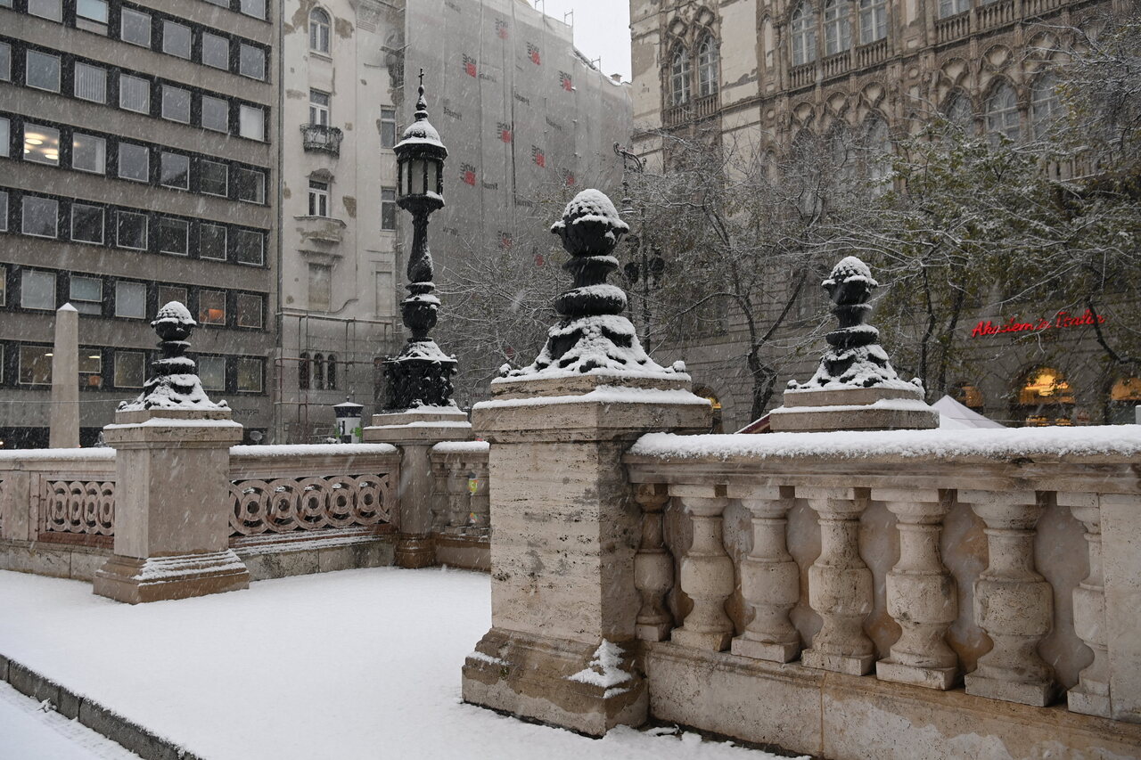
The heaviest snowfall of this winter is expected to come by Thursday in Hungary. By Wednesday evening, many parts of the country will be covered in white. In the Bakony Mountains, we can expect a snow cover of more than 30 centimetres!
According to Index, a precipitation zone will arrive over the Transdanubian region from midday on Wednesday. It will start with rain, and from the evening onwards, it will be replaced by snow and sleet in the western part of the Transdanubian region and around Budapest. From late evening, snow is likely in the western border areas.
Until Wednesday evening, most snow is expected to fall in the Bakony-Mecsek line, with 5-15 centimetres in flat areas. However,
snow layers of 20-30 centimetres may also develop in the Somogy Hills and the Transdanubian Mountains, as well as in the Bakony,
the National Meteorological Service said in its forecast.
Snowfall could continue until midday on Thursday, with several more centimetres of fresh snow expected. Persistent snowfall is expected in the western and north-western parts of the country, and the snow cover may persist in these areas, according to Időkép.
Until Thursday morning, 10-20 cm of fresh snow could fall in the Transdanubian region. In the Bakony Mountains, snow cover of up to 30 centimetres is expected.
The Börzsön Mountains covered in snow:
Snow has already replaced rain in the west, with sleet falling in the Bakony last night:
Read also:
Hungary heat record broken!

Southern Hungary experienced a hotter day today than ever on record, with the mercury reaching 18 degrees Celsius in Békéscsaba, the National Meteorological Service said on Facebook on Saturday.
The previous record was 17.4 C, recorded in Békéscsaba in 1959. Elsewhere in the country it was properly wintery, the coldest place being Nagykutas in Zala County, western Hungary, where the peak temperature was -0.5 C.
Read also:
- PHOTOS: Hungary covered by snow, 20 cm will fall in this region tomorrow – Read more HERE
Significant delays and cancellations concerning international trains in Hungary
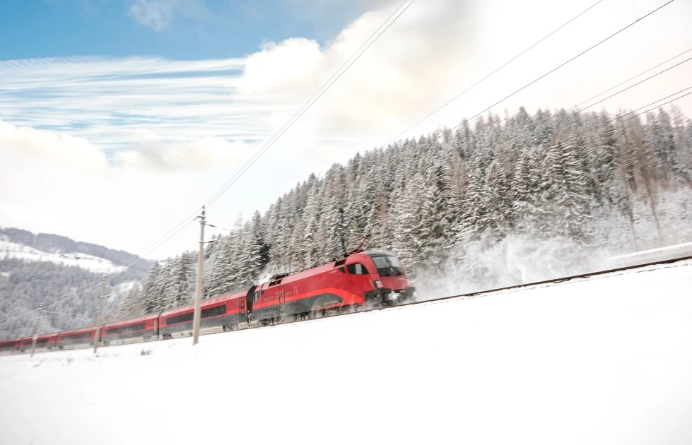
The amount of snow falling in the last few days was so huge that many international trains commute with significant delays in Hungary. Fortunately, we cannot blame the Hungarian State Railways for the situation. The international trains were delayed because of the heavy snowfall in Austria and Germany.
We wrote HERE that in some places, even 20 cm of snow fell in Hungary’s Western regions, but that is nothing compared to what happened in Austria and South Germany, especially Bavaria. We also reported how the Austrian State Railways (ÖBB) disconnected the international trains coming from Hungary because of their regular and significant delays. The reason for that was the renovation of the Vienna-Budapest railway line.
However, the current delays are not the fault of MÁV or other Hungarian institutions or companies. According to the Hungarian State Railways, considerable delays, cancellations and carriage modifications can took place concerning trains coming from the West.
That comes after an intensive snowfall in Austria and Germany, especially around Munich. As a result, regional and international trains suffer significant delays, and some cannot even start their journey.
Winter in Austria:
The routes concerned are Railjet, Eurocity, and Euronight trains coming from Munich, Salzburg or Zürich to Budapest via Hegyeshalom and Győr. Furthermore, the extraordinary weather also affects the Hungarian counterparts from Budapest.
ÖBB recommended all passengers to delay their journeys. The German State Railways (Deutsche Bahn – DB) did the same concerning all travels around Munich.
Passengers in trouble in Budapest can get help in the customers’ centre in Budapest’s Keleti railway station. For example, you may get tips for accommodation in the capital provided your train was cancelled or delayed.
The timetable was modified due to the extraordinary weather conditions. For example, Kálmán Imre EuroNight (EN 463) will not commute from Salzburg to Budapest today. Moreover, Wiener Walzer Euronight (467 and 465) will not come from Zürich on 3 December. Swiss and Austrian authorities will attach a night carriage to the trains because all hotels are full.
Here is a video about how much snow fell in Munich, baulking air traffic from and to the airport:
At Munich airport a plane that was supposed to fly to Dubai for a global warming summit was frozen on the runway 🤷♂️ pic.twitter.com/DCBvr9W9EV
— Roberto (@UniqueMongolia) December 2, 2023
Read also:
PHOTOS: Hungary covered by snow, 20 cm will fall in this region tomorrow
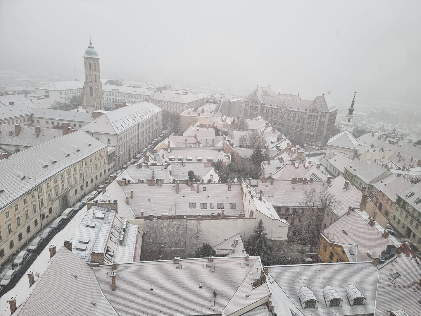
Heavy snowfall visited Hungary’s Northern and Northeastern regions earlier this week. Yesterday, Budapest and the central parts of the country were covered in a 1-5 cm thick snow layer. Tomorrow, a third Hungarian region will be covered by snow. In some places, the thickness of the new layer might even reach 20 centimetres.
According to Szeretlek Magyarország, the snowfall may reach 10-20 centimetres tomorrow in the Western regions of Hungary. Based on the snow map of Időkép, locals should prepare for freezing rain in the North.
Rains will rule Saturday in huge territories. We should expect snow in the Western, Northwestern and Northern regions. But the precipitation can easily change to rain in these regions.
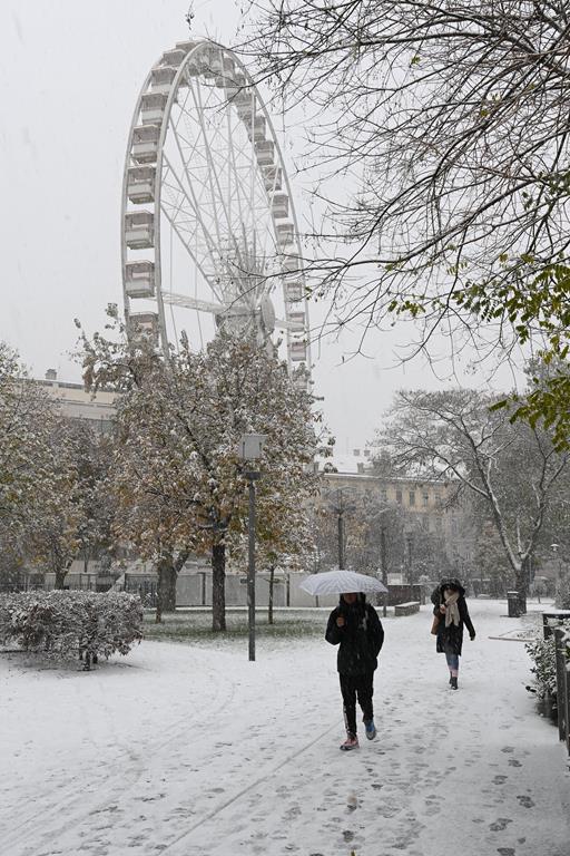
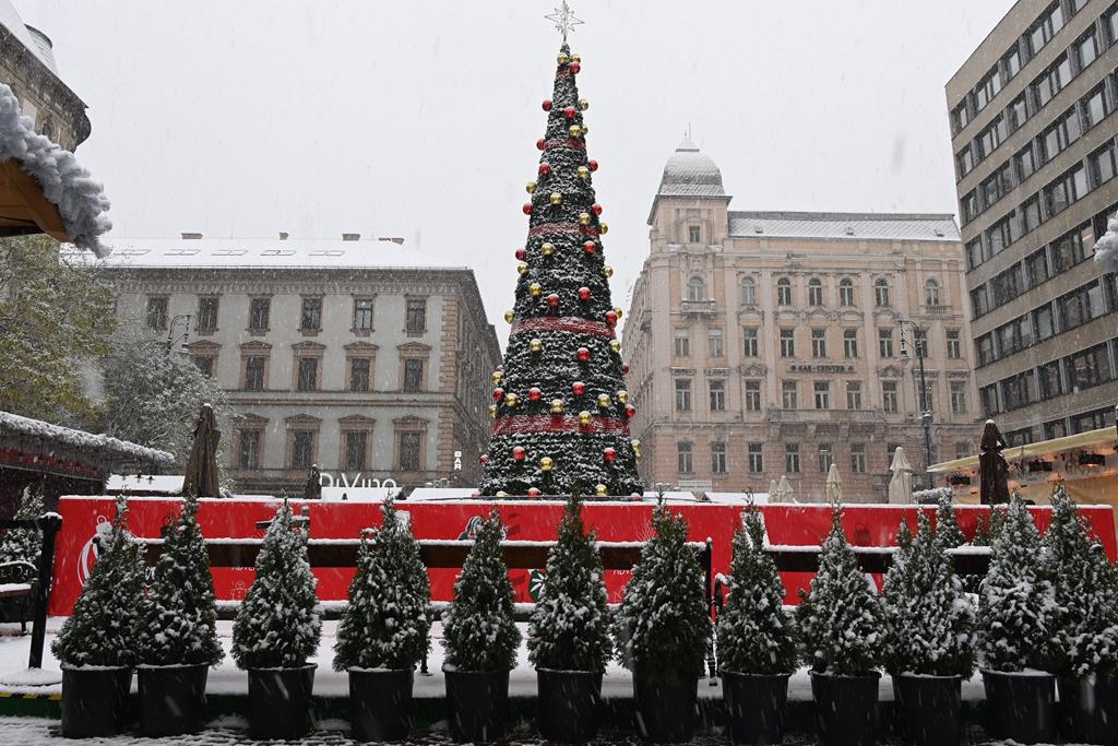
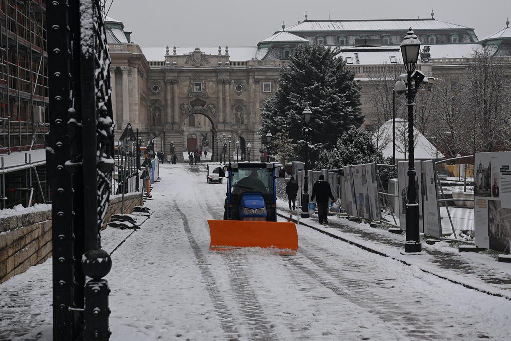
In the neighbourhood of Sopron and Kőszeg, close to the Austrian-Hungarian border, 10-20 centimetres of snow may fall. North of Lake Balaton, that layer can reach 2-5 centimetres. Here are four photos of wintery Budapest, the first one was made of the Buda Castle covered in white:
Budapest covered in snow
In the Transdanubia and the Northeastern regions, winds will get strong. By morning, there will be fog and steam. Daily maximums will be around 0 and 17 degrees.
On Sunday, snow will be rare, and we will see the sun. Northwestern winds will be strong, and the mornings will be cold. Temperatures will be between -3 and +4 degrees.
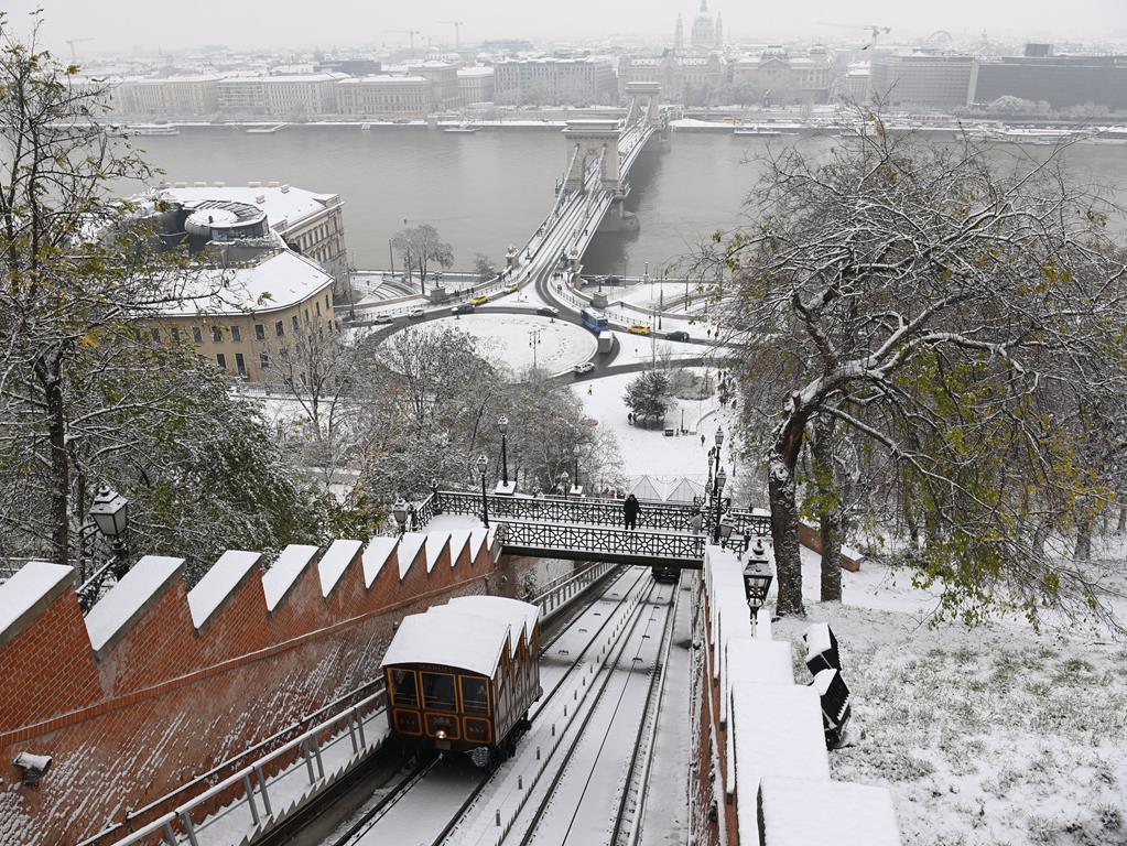
Here are some more photos of yesterday’s Budapest snowfall – they look magnificent:
Read also:
Meteorological service issues freezing rain alert for Budapest and northern regions
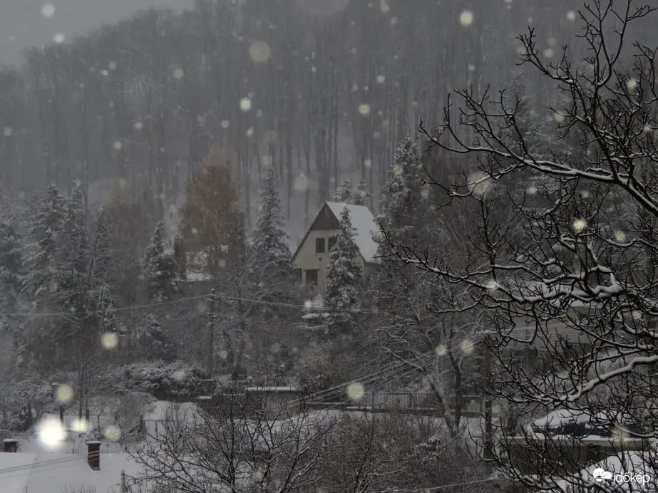
The national meteorological service (OMSZ) has issued a second level freezing rain alert for Budapest and the counties of Pest, Borsod-Abaúj, Heves and Nógrád, and warned of winter road conditions in most parts of the country.
With periodic snowfalls, sleet and freezing rain moving on from the western regions to the east, several hours of intensive freezing rain is expected to form thick ice layers in the capital city and in the northern mountain ranges on Thursday afternoon, the service said. In the Danube Bend and in Nógrád and Borsod Counties and the Mátra mountain up to 5 millimetres of snow is expected later in the day, the OMSZ said.
In the northern mountain ranges, in Szabolcs County’s north and in the Danube Bend 5-15cms of snow is expected to fall during the day, it said.
Later in the day, sleet and in places freezing rain can be expected in the southern, south-western regions.
According to forecasts, 20 millimetres of rain is expected to fall in the central Great Plain region until Thursday midnight to be followed by intensive rainfall on Friday.
Authorities have advised drivers and the public of observing precautions, follow weather and traffic reports and drive carefully.
Read also:
Budapest traffic paralysed by snowfall, public transport interrupted

Snowfall has paralysed traffic in the Hungarian capital. A total of 17 buses in Budapest have been diverted or are running in sections due to heavy snowfall, the Budapest Transport Centre (BKK) said on Facebook.
Bus No. 16 is not running between Deák Ferenc Square and Clark Ádám Square. Buses No. 40, 40B, 88, 88A, 140, 140A will run diverted, on the motorway. Buses No. 188 and 240 will not run between Sasadi Road and Károly király Street. Buses No. 58, 141, 158 and 250 are not running, Telex reports. Bus No. 8E is also diverted, with no stops between Sasadi Road and the BAH junction (BAH-csomópont).
A Telex journalist even saw one of the buses turned crosswise at the BAH junction stop:
Buses No. 27, 60A and 60B is not running, and bus No. 53 is not running between Márton Áron Square and Sasadi Road.
According to Mávinform’s Facebook post, the signalling control at the Déli railway station has broken down, which means that some trains only run to and from Budapest-Kelenföld. The problem mainly affects trains to Biatorbágy, Martonvásár and Lake Balaton. Due to the disruption, trains from and to the Déli railway station are expected to run 5-15 minutes longer on their entire route.
Read also:
Snow and sleet expected today in Hungary: here is where

Wednesday will be mostly cloudy and sunny. However, snow and sleet may develop in a large part of the country. From the second half of the day onwards, the wind will moderate.
Wednesday will be sunny for several hours in most parts of the country, but there may be some light snow and sleet in the eastern and northeastern areas. After strong gusts of wind during the night, the winds will lose strength during the day, according to the National Meteorological Service.
Daytime highs are likely to be between -2 and +4 degrees Celsius.
According to medical meteorology, the cold front effect is still prevailing in the east. Thus, people living here in particular may experience headaches, cramping and joint pains, Index writes. In the west and central regions, sunshine is expected, which will have a positive effect on well-being.
In a wide band of the Eger-Békéscsaba line, snow and sleet may develop today.
On Thursday, precipitation is expected again in several places, with snow and sleet in the north and northeast, and rain elsewhere. Daytime temperatures are expected to be between -3 and +8 degrees Celsius, according to Időkép.
Read also:
Part of Hungary covered in thick snow: here is what to expect

Thick snow blankets various northern regions of Hungary, particularly the Zemplén Mountains. We present you with some captivating snapshots of why you should explore these towns and villages if you seek an authentic winter experience in Hungary.
According to idokep.hu, thick snow covers several settlements in Northeastern Hungary’s Zemplén Mountains. The thickness of the white frozen precipitation reaches 13 centimetres in some places. Hungary transforms into a real winter wonderland in these areas, providing an ideal setting for building snowmen or snowcastles or engaging in a spirited snowball fight.
Moreover, in Bózsva, the thick snow has already reached 20 centimetres, quite possibly setting a current record in Hungary. Snow is present only in a few places, mostly in the high terrains of Börzsöny, Cserhát, Mátra, Bükk and the Zemplén Mountains. However, we hope there is more to come in December since snow has become a rare spectacle in the lower regions in Hungary.
Here are some photos:
Dobogókő yesterday:
And this was yesterday’s prognosis:
Anticipated weather for the second half of the week
Looking ahead, Tuesday promises rain, with snowfall anticipated only in the northern and northeastern regions of Hungary. Around Sopron, the wind will turn gusty Temperatures will fluctuate between -1 and +8 °C, as reported by idokep.hu.
Wednesday is poised to be sunnier, yet flurries and snowfall will persist in the north, with temperatures ranging from -1 to +4 °C. The same goes for Thursday, with expected rainfall and afternoon temperatures peaking at +10 °C. As we move into Friday and Saturday, temperatures remain brisk, with rains prevailing and snowfall confined to the northern and northeastern regions. The northern wind will pick up, while the temperature reaches a maximum of 15 °C in the southeastern regions.
All in all, if you want to have a real winter experience in Hungary, you will have to go north these days.
Read also:


