Are you confused by the districts in Budapest? – Here is our guide!
Some numbers follow each other in a reasonable fashion in the Hungarian capital. For example, the main roads come one after the other, clockwise. Their starting point used to be the threshold of the royal palace. That was later modified to the Adam Clark Square. Road Nr1 goes to the former imperial seat in Vienna, nr 2 to the North, nr 3 to the North-East.
In contrast, the numbering of the Budapest districts
seems to be in total chaos upon first (and also second) glance.
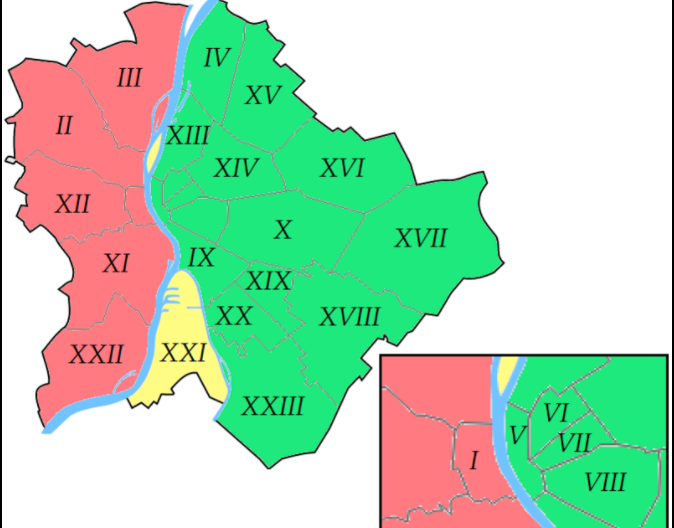
To reach District 4 from District 5, you have to cross District 13, while between districts 10 and 11, there is District 9. Why?
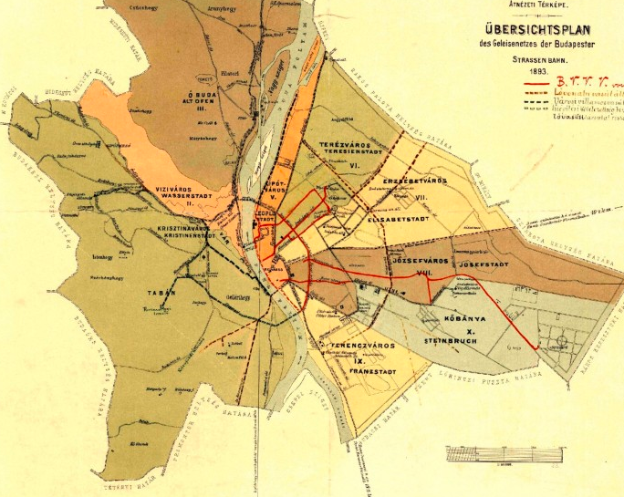
In 1873, when Buda, Óbuda, and Pest united, there were only ten districts, Telex reported. Buda became the 1st district while Óbuda the 3rd, and the territory between them was District 2. On the left-hand side of the Danube, the numbers followed the historical development of the city. The centre was Pest (District 4), and it had four suburbs. One of them, Terézváros (Theresa Town, District 6), was so big already in 1873 that the leaders of Budapest created Erzsébetváros (Elizabethtown, District 7) from parts of it.
This is how the map of Budapest looked in 1873:

There was a huge debate concerning the future of Kőbánya, but finally, they decided to create a new district (the 10th).
- The ‘alcoholic’ history of Budapest – VIDEO
- The brief history of the tramways of Budapest
- Happy 147th Birthday to Budapest!
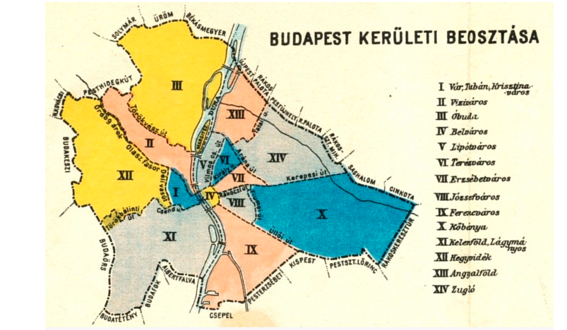
This system survived even WWI, and it was only modified in 1930. The leadership of the city made some new districts by dismembering some of the old ones. For example, the “mother” of districts 11 and 12 was District 1. Moreover, districts 13 and 14 were created from districts 5, 6, and 7. That is because in the 19th century,
the plot ratio of the city was much lower than in the 1930s.
As a result, District 13 is between districts 4 and 5 today. You can check that on the map below:

Interestingly, Csepel, one of the most industrious parts of the city where the Manfréd Weiss Steel and Metal Works was, belonged to District 9 at the time. Furthermore, the new districts received new names, but they did not take root. For example, only a few inhabitants of Budapest know, if any, that District 12 was Mathiastown while
District 13 (Magdolnatown) was named after Governor Miklós Horthy’s wife.
In 1950, new modifications were made since 23 settlements were attached to Budapest from small villages, such as Pesthidegkút, to big industrial cities, such as Újpest. They received the numbers between 15 and 22. In 1992,
the people of Soroksár decided to become independent from District 20 (Pesterzsébet).
As a result, they became District 23 in 1994. The current situation is shown in this map:

Source: telex.hu


